Hurricane Wilma video diary and photo blog from Marco Island and Naples Florida.
I have updated my Hurricane Wilma blog page to cover everything in regards to my Hurricane Wilma intercept.
Once again I in Florida to document a hurricane just when I thought the season was over and now Hurricane Wilma shocked everyone.
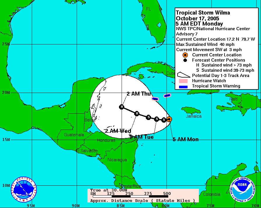
On October 16th, 2005, Tropical Depression Twenty Four formed south of Cuba and turned into a weak hurricane the next day. The next morning on the 17th, it looked as if Wilma was on track to head towards Central America. The forecast track was still early for this storm and with it being so late in the season, I did not hold out too much hope for it making a landfall in America.
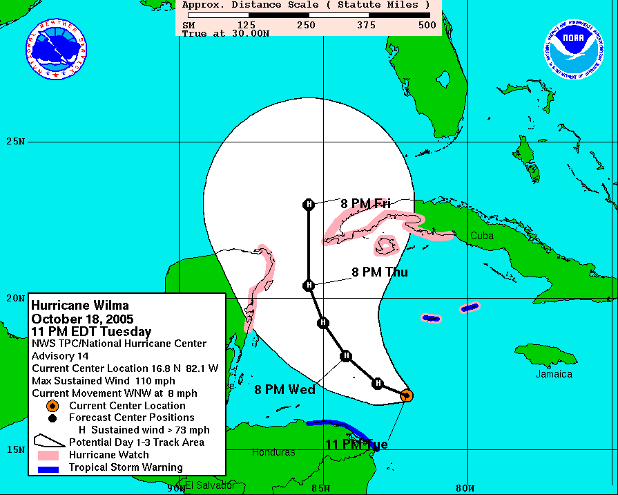
When I went to bed on Tuesday October 18th, I was starting to get my hopes up for one more hurricane intercept for my historic 2005 hurricane season. Wilma was now up to 110 MPH and the forecast track was for it to move between Mexico and Cuba.
The next morning, everything about the 2005 hurricane season just changed. Hurricane Wilma just blew everyone away and broke some records with how fast it grew in intensity during the overnight hours. Wilma went from a Cat 1 the day before, grew into a Cat 2 and jumped to a Category Five hurricane during the overnight hours with winds of 175 miles per hour, and the forecast track had it heading for the Gulf Coast.
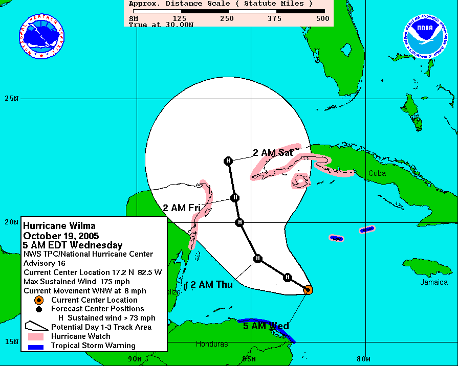
On the morning of October 19th, Wilma’s wind speed had dropped back down to 155 mph but it was still a monster Cat Five Hurricane. The forecast track showed it was heading towards Cancun Mexico.
Now I really wanted to head to Cancun Mexico to intercept Hurricane Wilma and I could have got on a flight but due to the dangers of the storm and being outside of the US and the fact that the only Spanish I know is what you say at Taco Bell to order food, I decided to play it safe and wait until it hit Florida.
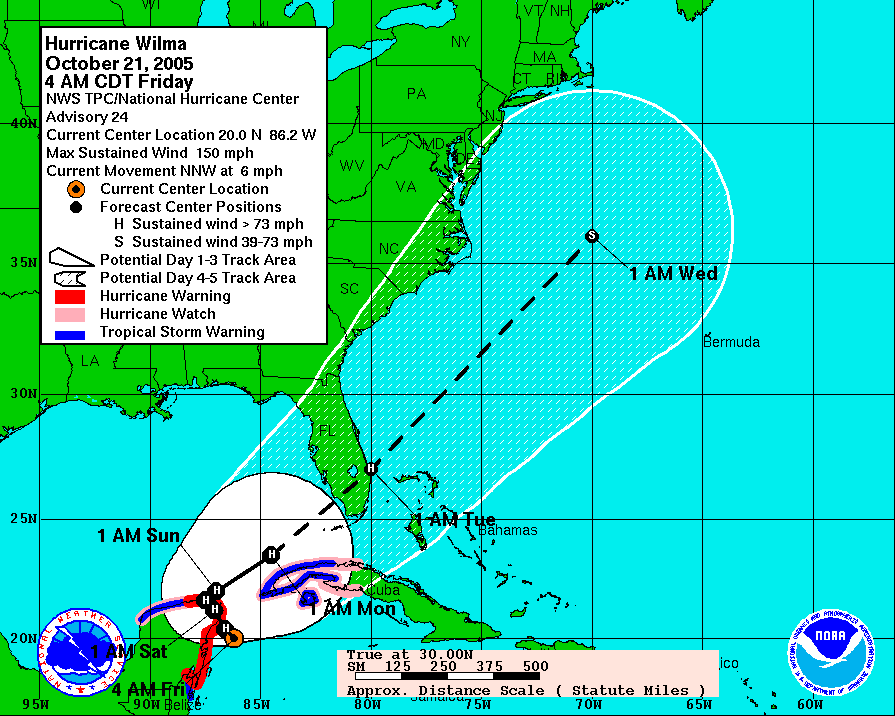
I flew into Florida on Friday October 21st to make sure I was in place and able to move locations if needed. I also needed to take care of some business and met up with Chris to wrap up some stuff on the prior years hurricane stuff to make sure the last of the merchandise was not destroyed by Wilma.
My target starting point was Fort Myers with a target ground zero of Marco Island to Naples Florida. I was very confident of my target area and stayed in Punta Gorda Florida for this hurricane.
If you read my Hurricane Charley blog, you will know that Punta Gorda was where I was for last year Charley. It was great to be back in town and meet up with all the friends I made there at the Pub. I will say that they were worried to see me with a hurricane forecasted to be coming because they thought maybe they would get hit again by Wilma. I told them I was staying in Punta Gorda because I like to stay outside of where the eye will make landfall so I have a place to go back to after the storm.
This chase was going to be different because I was going to chase with a new friend Brian who shoots a lot of underwater video, his web page is www.subsurfacemedia.com.
Brian contacted me a while back and he wanted to come with me to intercept the eye of Wilma and get a feel for how to work in the fast paced electronic news gathering environment.
On Saturday, I drove up Sarasota, FL to meet Brian at his home and plan our Hurricane Wilma intercept.
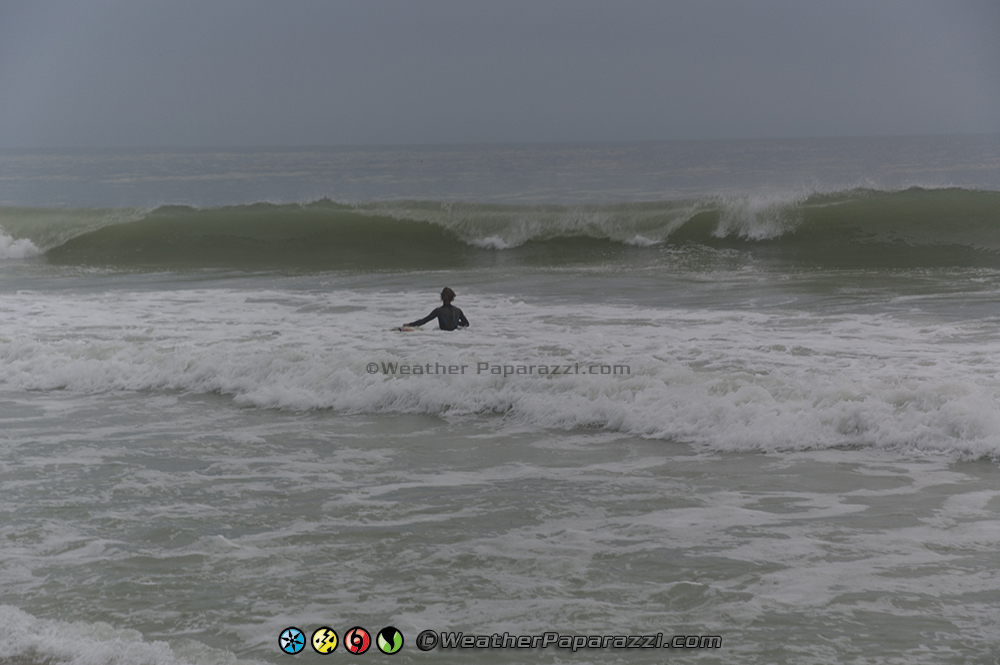
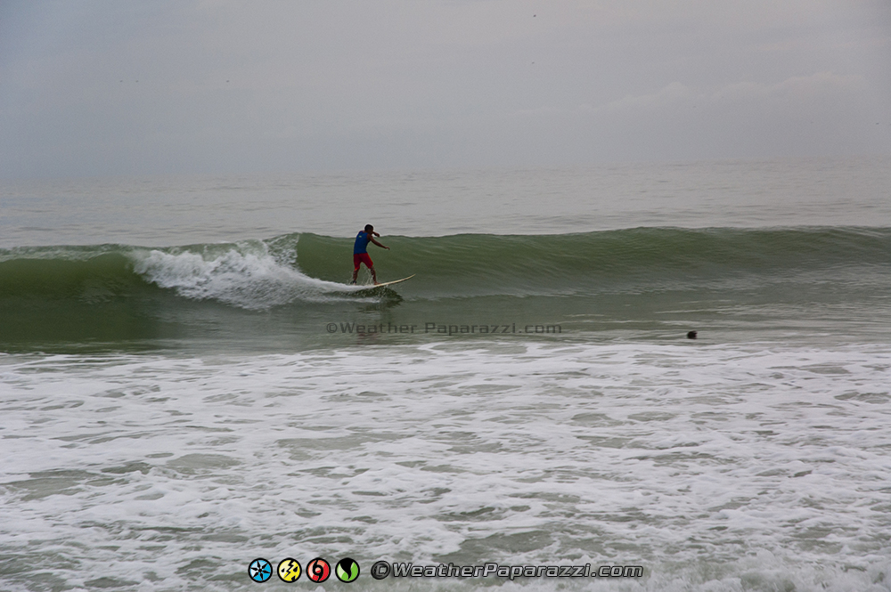
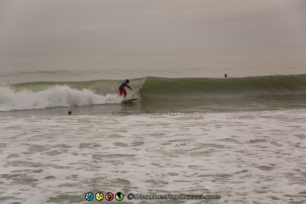
We had all day Saturday to plan the chase which did not take too much planning because my Marco Island target was about as good as it was get unless we drove to Key West. I wanted to get in the eye and all the forecasts showed that Marco Island was the place to be. Since we had the rest of the day to kill, we went to go check out the beach to get some footage of people surfing the waves that were kicked up by Hurricane Wilma as it sat over Mexico.
With time to kill, we suited up in the wet suits and tested out the equipment in the waves. The first video is a video that Brian took that shows me and the big waves moving in from the Gulf of Mexico to test the waterproof gear.
After a short break to dry off, we went back to Siesta Key, FL to film the Surfers catching some rare big waves in the Gulf of Mexico as a result of Hurricane Wilma and the large wind profile as the storm stalled out over Mexico.
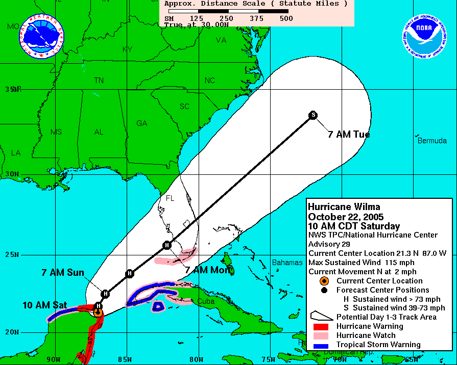
Hurricane Wilma had pretty much stalled out over the Yucatan Peninsula for the last 36 hours and the maximum wind speeds dropped down from 145 mph at 10:00 a.m. on Friday morning to 100 mph at 10:00 p.m. on Saturday night and was forecast to make landfall in Florida within the next 36 hours.
From the looks of the people checking out the waves Saturday night in Siesta Key, Florida, it didn’t look like people were too concerned about the storm.
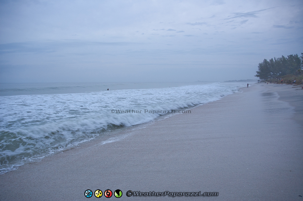
As we wrapped up shooting footage of people surfing along the beach in Siesta Key, FL, I thought to myself that this was the last sunset that I was going to see for a couple of days and hoped it would not be my last ever. Wilma was still a Category Two hurricane and was still very dangerous so I had to tell myself not to get careless or over confident even though this was my ninth hurricane intercept in just 14 months.
The end of this video was from Port Charlotte, FL where I saw a sign on a bank that had a cartoon of Wilma form the Flintstones and the words saying Spare Us Wilma
The forecast showed a trough building that would accelerate Hurricane Wilma to the Northeast over the next couple of days and then some much cooler temps after the storm. If the forecast verified, we would be in perfect position in the area to Naples and Marco Island, Florida.
Since this was Brians first eye wall hurricane intercept and he was not driving a SUV, the plan was for us to chase the storm in the two locations for pre-surge and post surge. We would start in Naples and then move to Marco Island before the eye hit and then reposition back to Naples in the eye to avoid the storm surge and flooding that could trap us there for a days .
It was now Sunday afternoon; I had slept for most of the morning and knew that I was going to need to get as much sleep as I could before I met up with Brian at my hotel in Punta Gorda, FL. I did go to the Celtic Ray Pub to get one last hot meal of Fish and Chips for lunch. The owner of the Ray said they were not closing down for Wilma so when Brian met up with me at the hotel and said he wanted to get something to eat, I sent him over their and took another nap for an hour before it was time to get going.
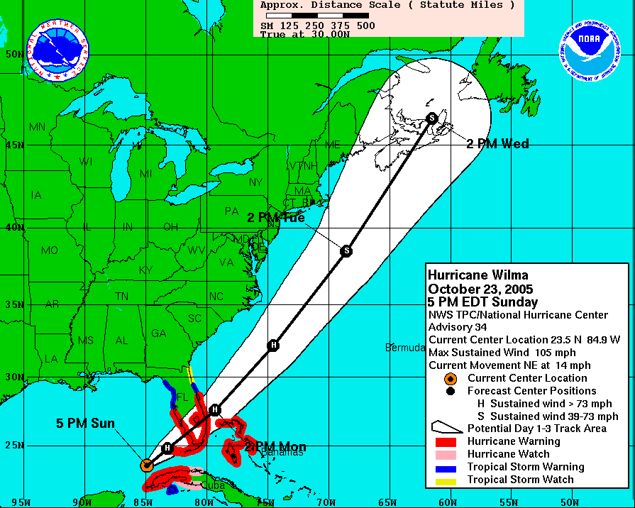
It was now after 6:00 p.m. and the forecast for Hurricane Wilma to be pulled to the northeast by the trough had verified. Wilma was about 200 miles to the west-southwest of Key West, Fl and moving to the northeast at 14 MPH. Our target for Marco Island and Naples Florida was verifying and it was just a waiting game now for the hurricane to show up in the next 8 hours. We had a hour drive ahead of us and a last minute fuel stop to top off the tanks before we hit the road.
The radar out of Key West, FL showed that the outer bands of Hurricane Wilma were not even impacting the area yet so we did not hit the road until 8:00 p.m. to make the hour long drive down to Naples, FL. From what I was hearing on the news, the police were out in force with the curfew and in the Post Katrina hurricane, the police will not be screwing now so we needed to be there when the storm was actually doing something.
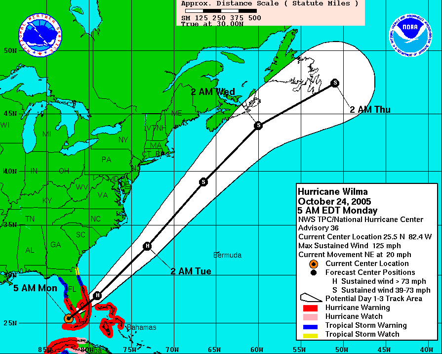
As we were rolling into Naples, FL, the 11:00 p.m. forecast from the National Hurricane Center came out and it showed that Wilma went back to a Cat 3 hurricane with winds of 115 mph and the eye of the hurricane would pass right over Marco Island, FL.
I was supposed to meet up with another friend, Bill Reid from California, but as we were heading into Naples, his cell phone died and I lost contact with him when I got into Naples. The last I heard was he was riding out the storm with another friend of his in Naples, so he was all set for the storm.
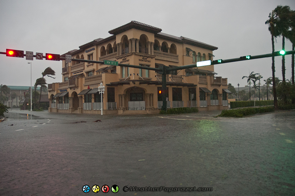
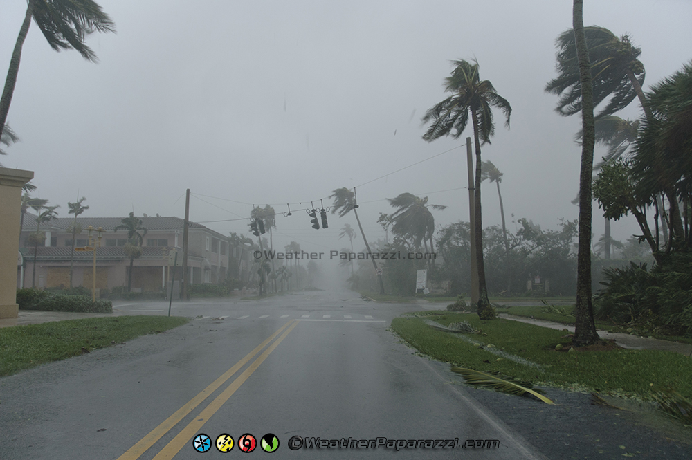
Brian and I got setup into position in Naples, FL just before midnight where we were shooting video of the police patrolling the streets along 5th Avenue and Highway 41. The police left us alone since we were clearly with the media covering the Hurricane but they did stop a few cars because of the curfew.
The second half of this footage was at the coast to document the waves coming on shore as surge and larger waves were starting to move in as the eye of Hurricane Wilma moved closer to the area. The video ends with several police cars passing by are location on 5th Avenue.
Once on Marco Island, I was not that worried about storm surge for the first half of Wilma due to the fact that the storm was moving so fast and we were going to hit the eye almost head on its northern side. My feeling was that the major flooding was going to hit the Florida Keys but the eye would go north over us. I was still kind of worried that I could be wrong and I would be out of luck if it turned to the east at the last minute like Hurricane Charley did. My luck held and the good lord was watching out for us, again…
The latest forecast from the National Hurricane Center showed that Willm was a Category Three Hurricane with winds of 125 MPH and was still coming for us on Marco Island.
As the eye northern part of the Eye of Wilma was moving toward us on Marco Island, I felt relieved and a huge forecasting weight lifted off of me since we were going to get into the eye of the storm. Unlike the east coast of Florida where it is heavily populated with plenty of road options, the south west coast of Florida does not have any roads or towns that run along the coast. It was pretty much Marco Island or bust. There was an option to head over to Everglades City, FL but due to the remote area, I was trying to avoid this area.
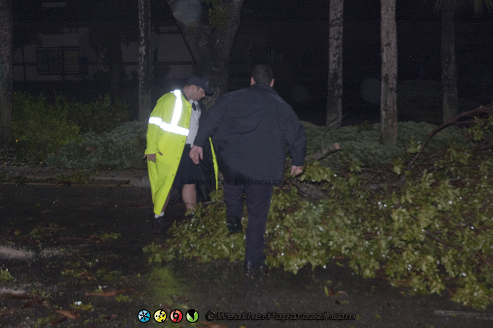
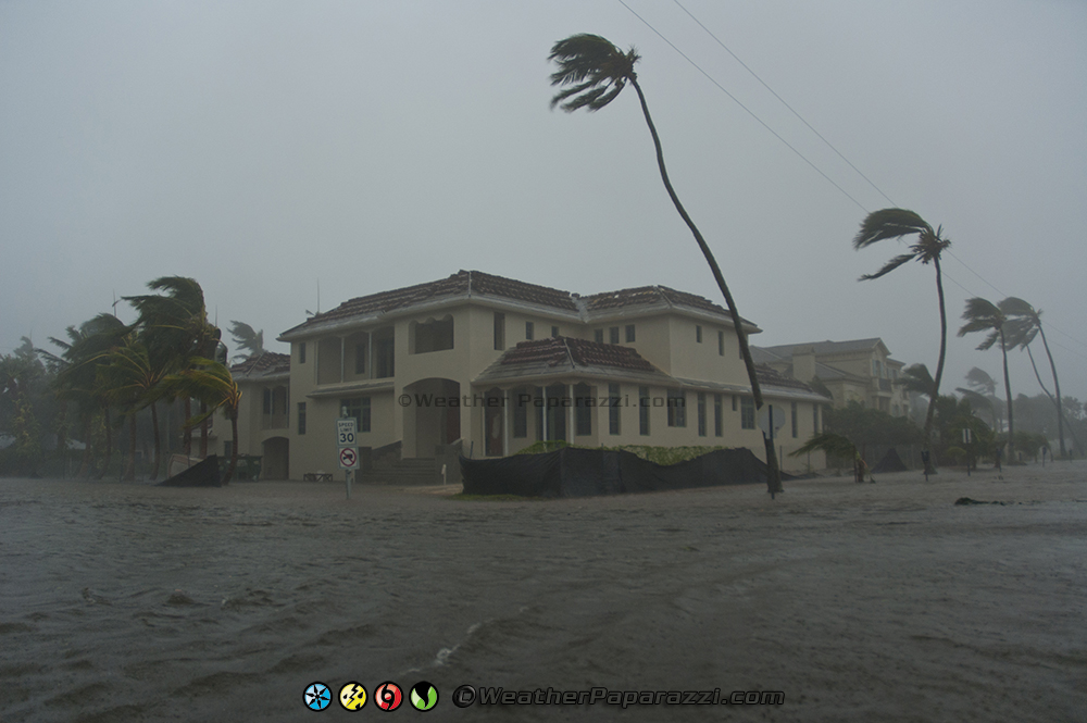
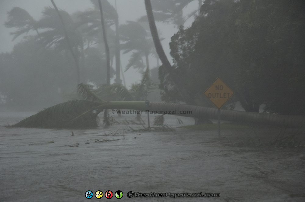
As the eye wall of Hurricane Wilma was moving closer to Marco Island, FL, we did see the police were out even during the height of the storm to protect the island from anyone even thinking of looting. I told the officers what we were doing and said I had my social security number written on my arm with a Sharpie and were with the media. They were cool with us and told us were we could find a parking garage to get into if the storm surge started to cover the island. We got some great footage around Marco Island before all the power went out and we could not see anything in the dark. The winds were incredible.
When the winds started to become about 90 mph sustained, it was time head over to the parking garage the cops told me about and it turned out to be the same garage that we scouted out earlier.
The drive over to the parking garage was not fun. I think I used up another favor with the lord while driving in the eye wall at night in the dark. A good eight foot long and foot wide top of a palm tree snapped off and landed right in front of my rental SUV. Thank god we were only driving about 10 MPH in the darkness since the white out conditions made it impossible to see where we were driving. If that log would have landed on top of the truck, I would have probably been killed or seriously hurt. It was only a mater of seconds or a few yards travel distance that saved me. The only damage was a broken parking light and messed up front bumper.
We drove up to the top of the parking garage and the winds of the hurricane were incredible. With the wind speed increasing with height, we were seeing 120+ MPH wind with higher gusts. The only problem was it was at night and we only had one light from the parking garage at the hotel which was on backup power to illuminate the area for us. After a few minutes on the top of the parking garage, we relocated to a safer area near ground level as the eye wall hit the area and the winds went from extreme to calm.
Now it was a race against time in the eye of Hurricane Wilma.
Once the eye of Hurricane Wilma hit, I had a feeling my luck would run out. Brian and I checked out some of the damage around the island but we could not see much in the dark.
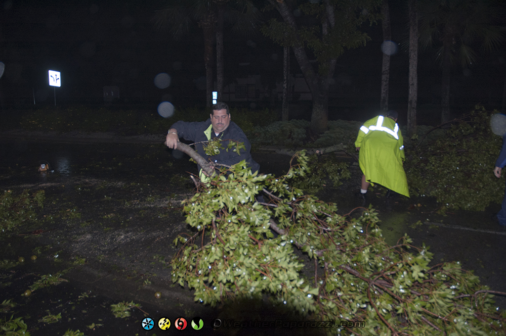
We did stop to check out the police trying to clear up some downed trees from the main roadway but could only spend a few minutes checking out damage before making the decision to get off the island to avoid the storm surge.
We drove off the island in the calm of the eye of Hurricane Wilma. I was watching the Key West radar the whole time during the hurricane so I knew the eye was still huge and we had about an hour from one side of the eye to the other. I had some major camera issues so I only had one camera running during the hurricane which is why I shot very little dash camera footage. I did manage shoot footage while driving off the island. After we got off Marco Island, we saw in the dark what looked like a geyser shooting up out of the middle of center divider of the road from a water main being damaged by the wind.
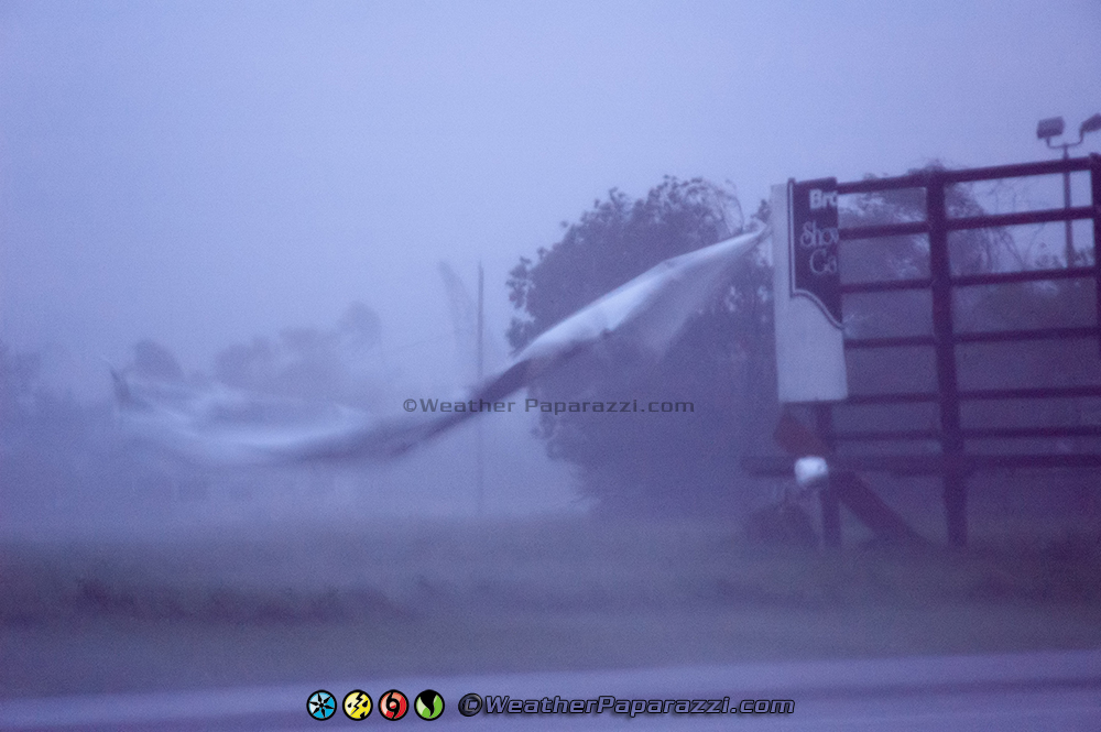
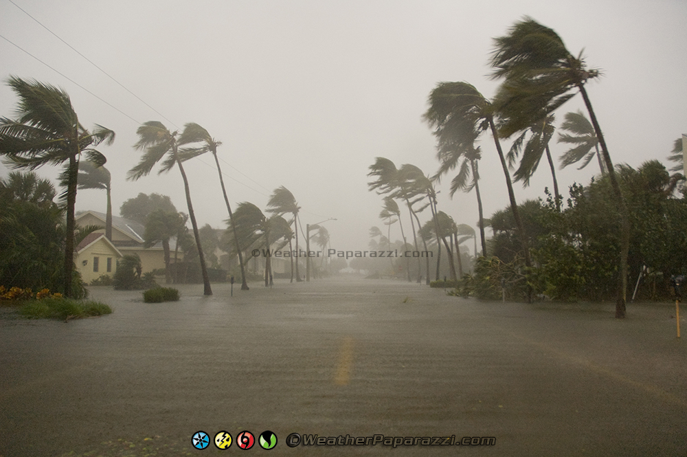
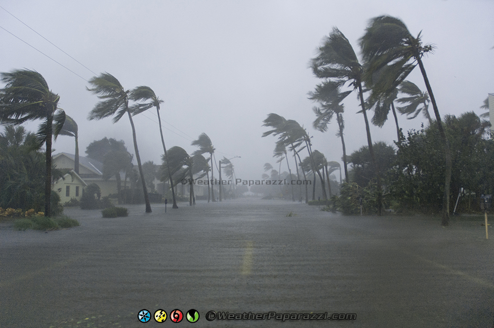
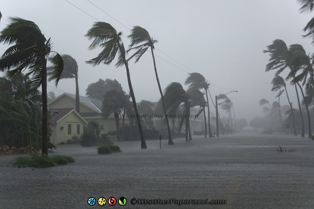
Once off of Marco Island and back on Highway 41 North, we were just south of Naples when we entered the second half of Hurricane Wilma’s western eye wall. The winds went from calm to hurricane force fast. While in the western eye wall, we drove slowly back towards downtown Naples to where we were shooting video before on 5th Avenue.
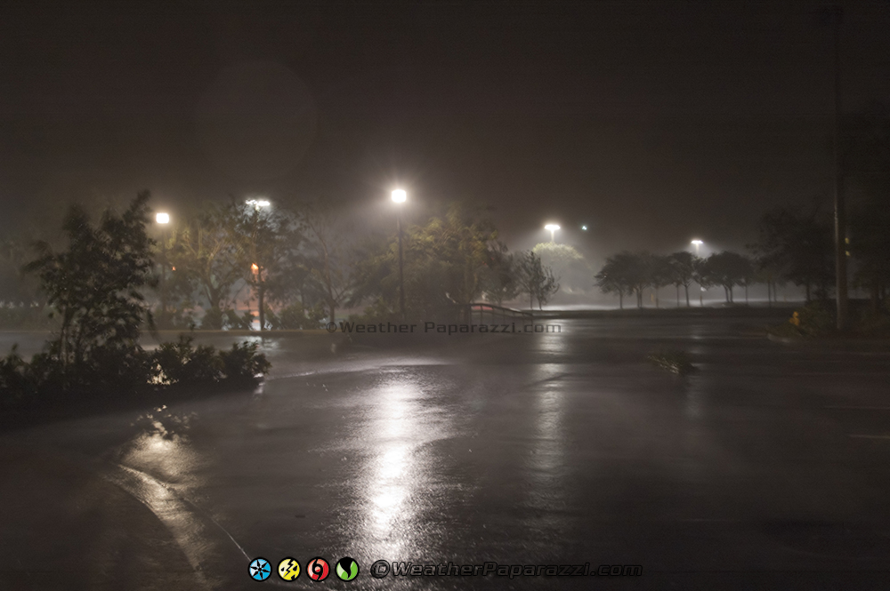
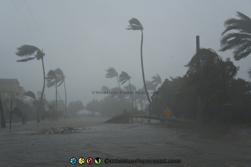
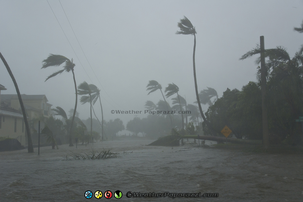
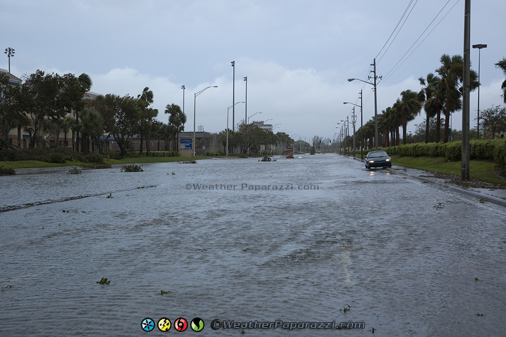
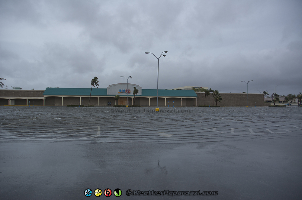
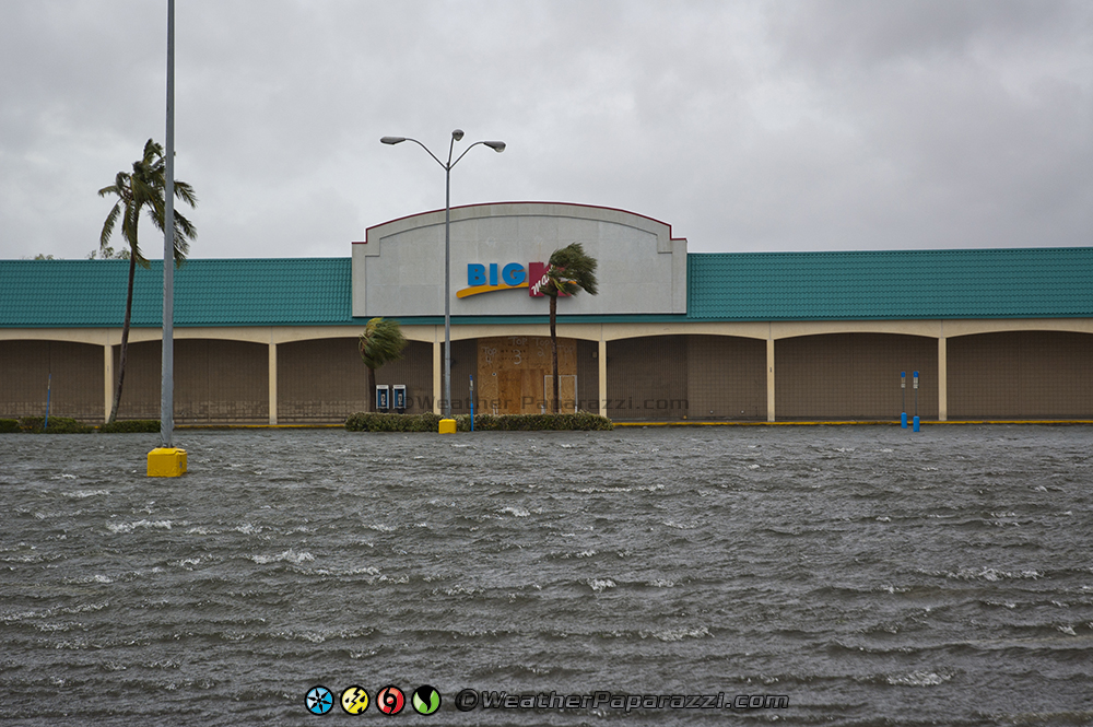
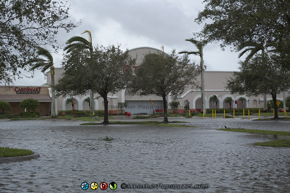
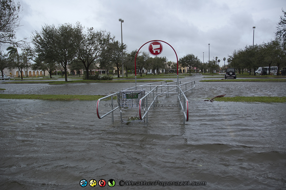
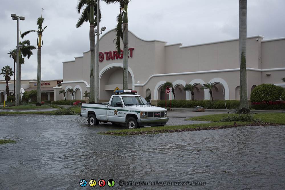
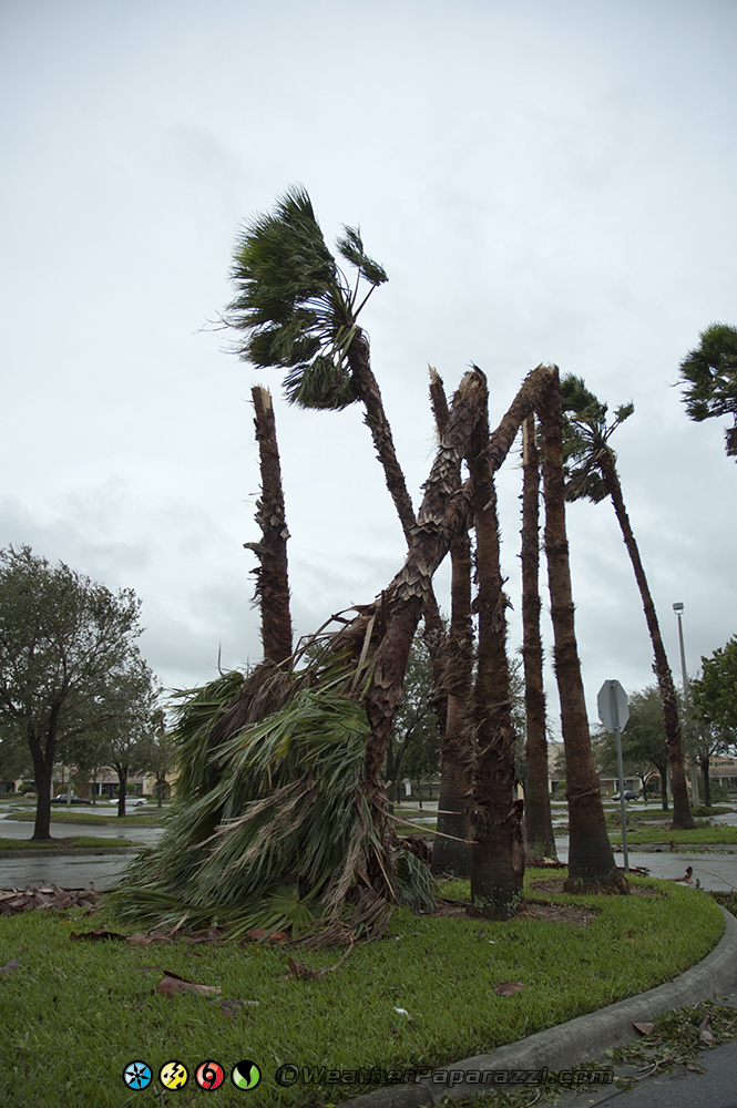
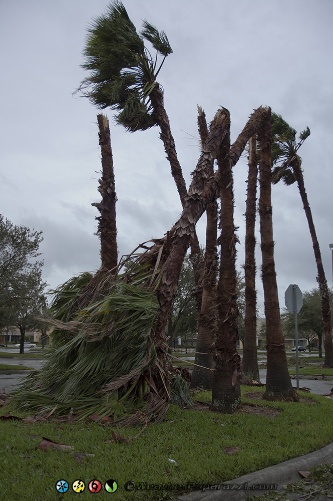
Now instead of police all over the streets, it was debris and flooding all over the street with category two winds. The winds were blowing a lot of coconut’s all over the place from the busted up palm trees. At this point, I was not sure if the flooding was from the heavy rain or storm surge but my guess at the time was just from the rain.
Brian and I could not shoot everything together since he was driving a car and I was in a SUV. This was the main reason we left Marco Island and drove back to Naples so he would not get stuck in the flood. In Naples, the street flooding prevented Brian from driving around except for in the heart of town on 5th Avenue.
I on the other hand was trying to check out as much as possible further down the road to Gulf Shores Blvd and Fifth Avenue where I got some great footage of the high winds blowing through the trees with the flooded out road. I could not tell how deep the water was and there was at least a couple trees blocking the road so I avoided driving any further down to the beach and headed back to where I left Brian.
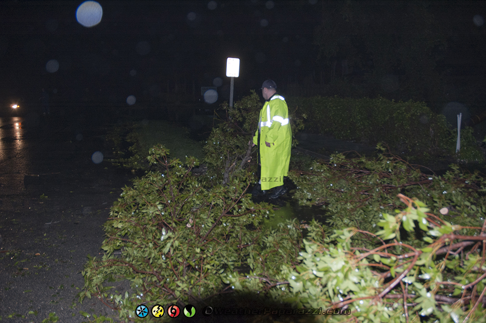
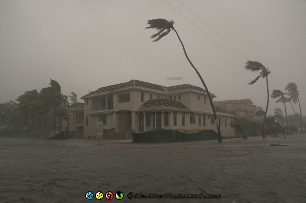
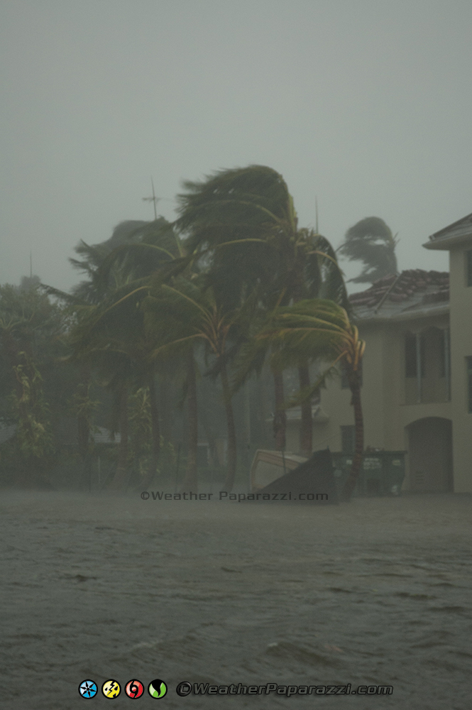
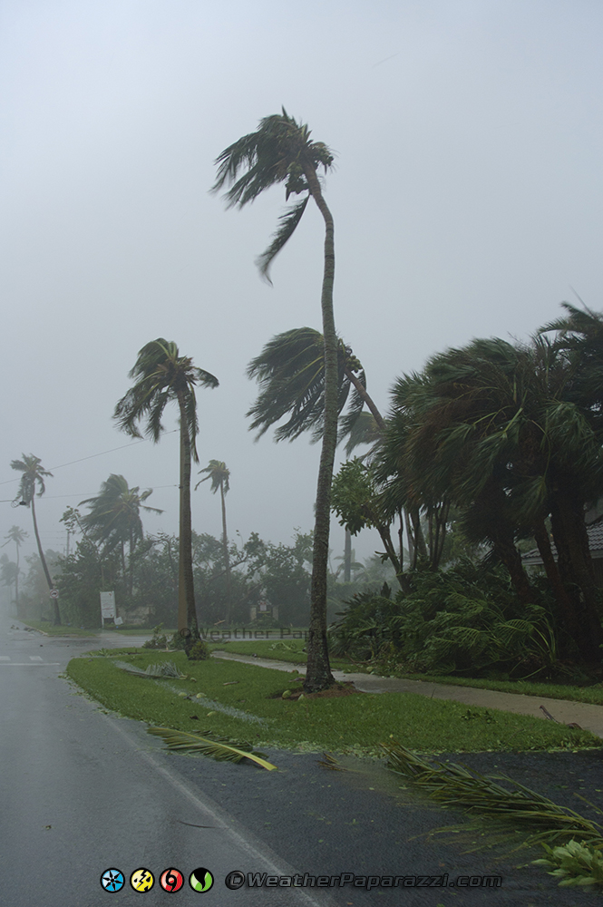
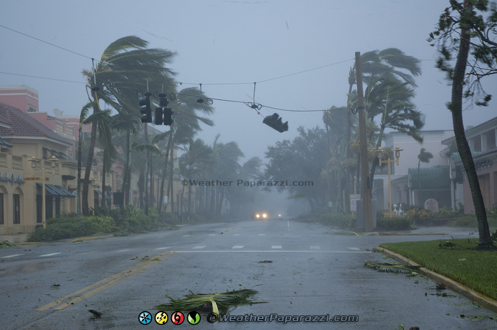
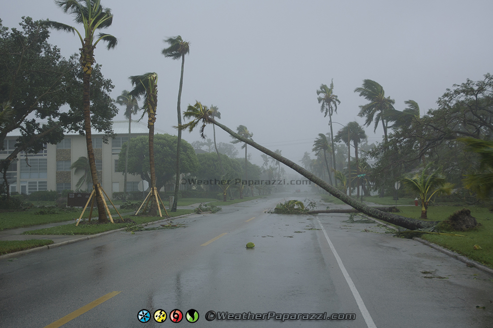
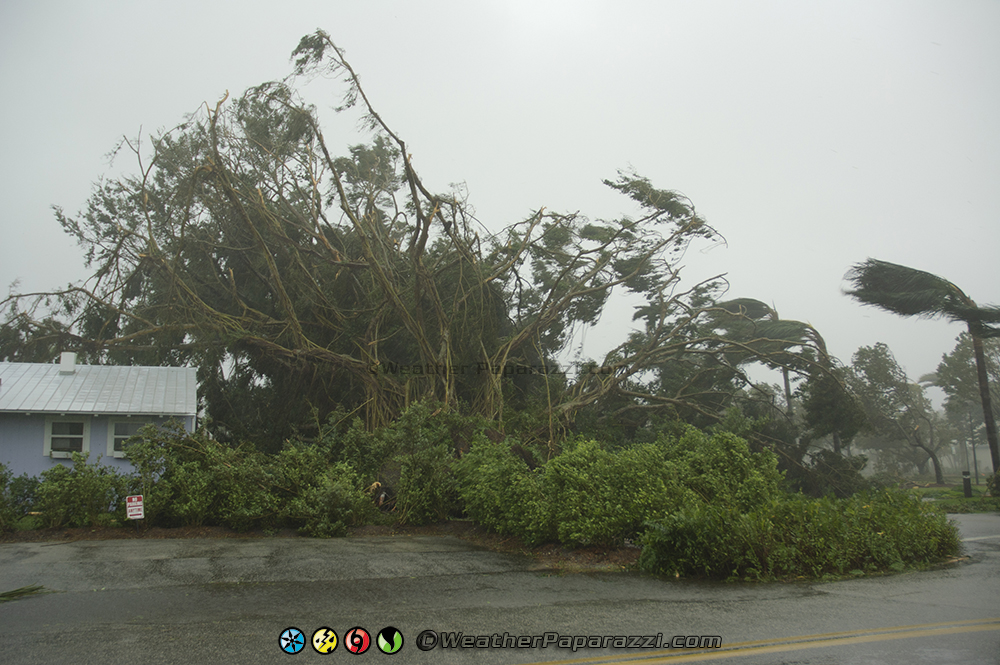
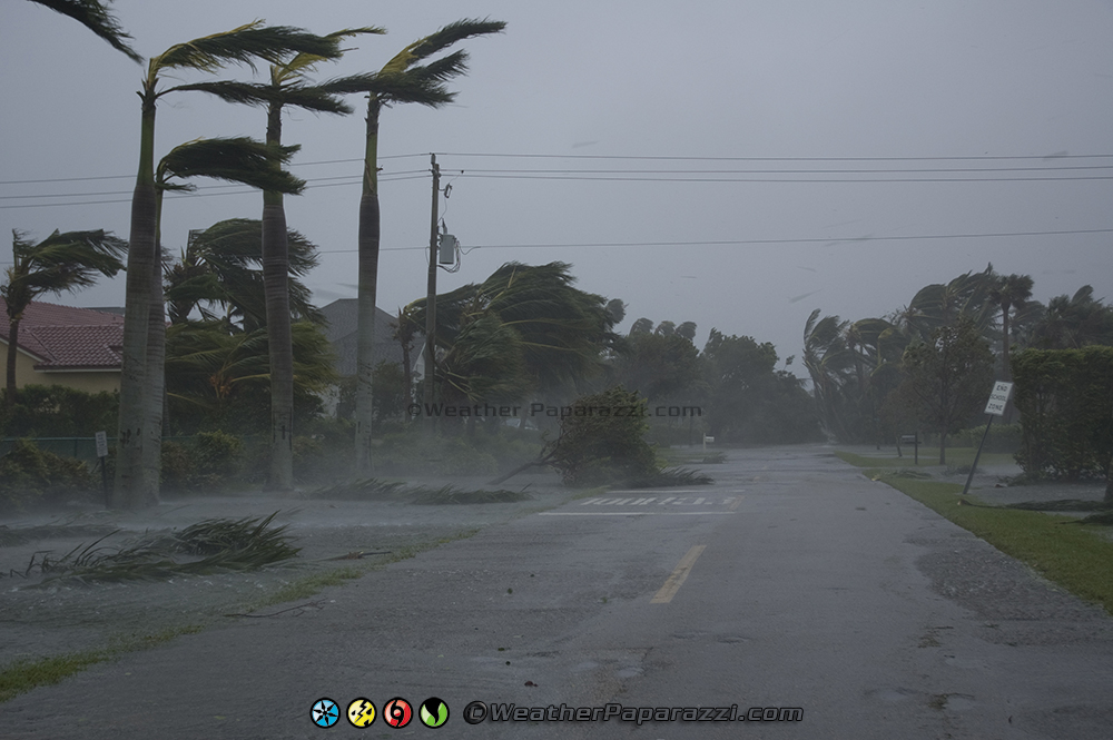
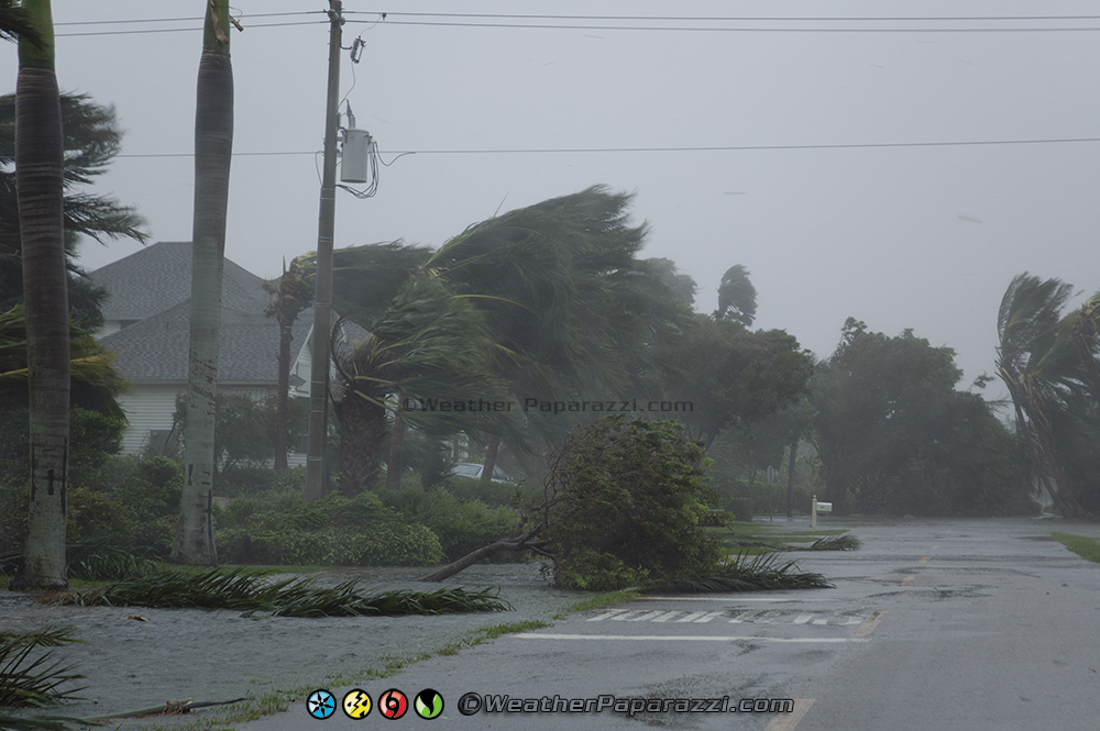
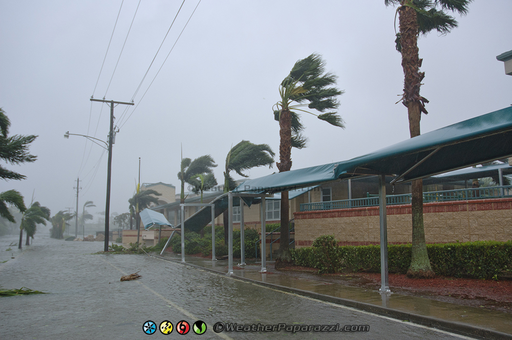
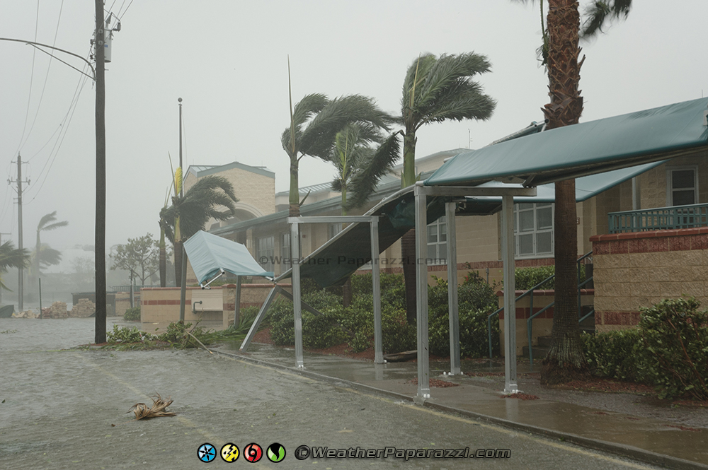
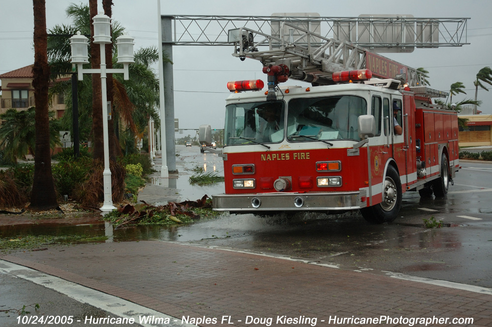
The eye wall of Hurricane Wilma was hitting Naples, FL and doing a lot of damage before moving off to the northeast. The winds were gusting to 120 mph but the sustained winds were about 80-100 MPH before the eye moved towards the east coast.
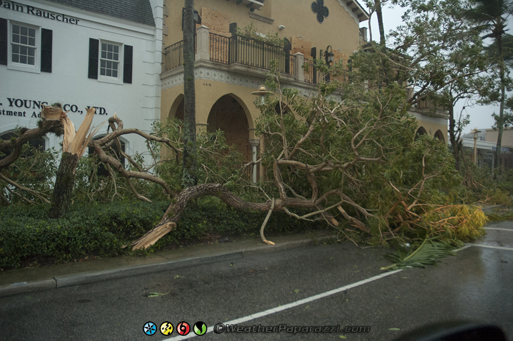
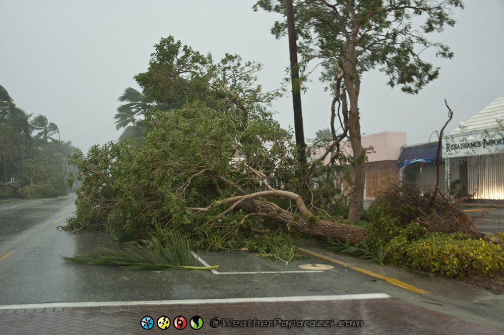
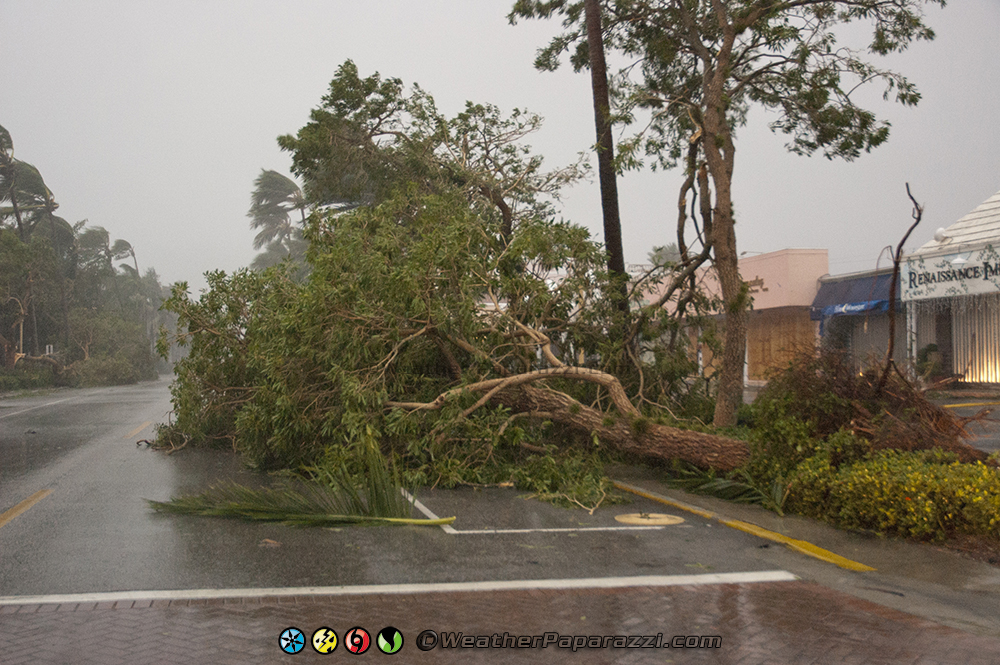
As a hurricane chaser, this was the best part of the storm since it was now daylight and we could see the power of Hurricane Wilma hitting the city of Naples, FL. Roofs were being torn off buildings and trees were being knocked over in the high winds. All we could do now is document what was happening and hope that we did not get killed or anyone that lived there did not get hurt.
I know if someone that lived there was reading this saying this guy was having fun watching my town get destroyed they might get upset. Hey, I’m a freelance new cameraman, and when you get a good story, of course I would get excited. This was the end of a week of planning, forecasting and logistics to make sure I was at the right spot for the story. And when that all works, its like hitting the weather forecasting lotto.
As the winds of Hurricane Wilma were starting to drop below hurricane force on the back side of the eye, Brian and I moved around a few block area towards 8th Avenue. We documented the winds hitting St. Ann’s Catholic School before moving back to 5th Avenue and then finally taking a break in a parking garage on 8th Street.
The wind speeds by the time we got into the parking garage and got a bite to eat out of the cooler had dropped to below hurricane force.
With the strong winds fading fast, we shot the last of the high winds from atop the parking garage where tropical storm force winds were still blowing pretty strong for about another 15 minutes. Even though the storm was moving on, the winds were still ripping up shingles on roofs and destroying property.
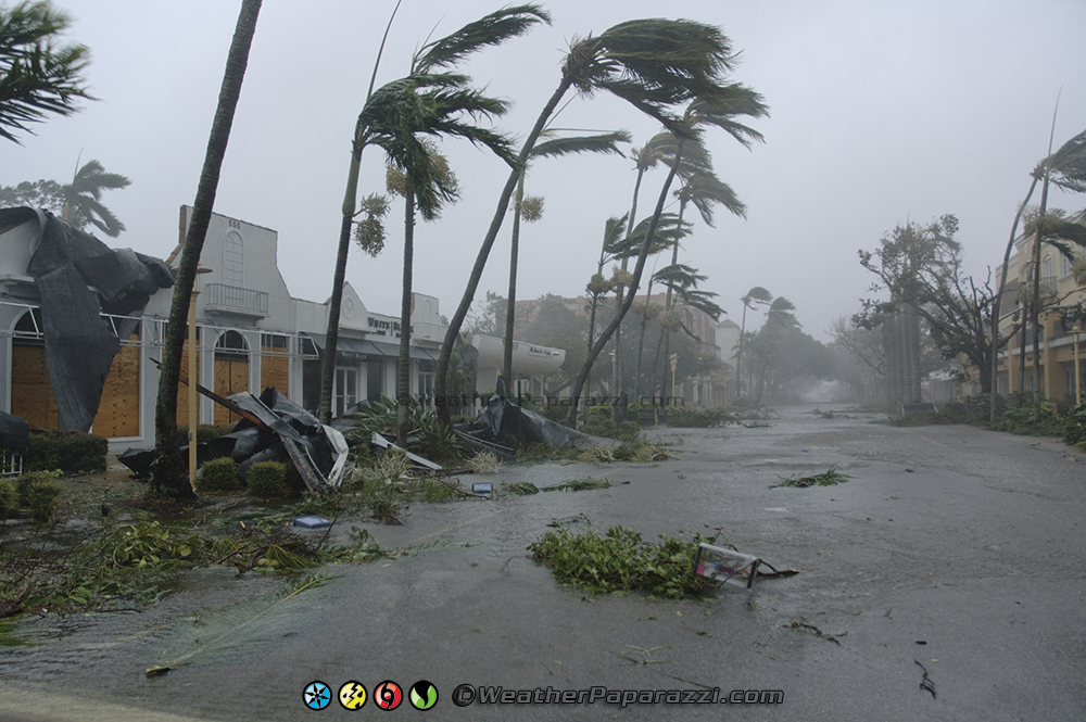
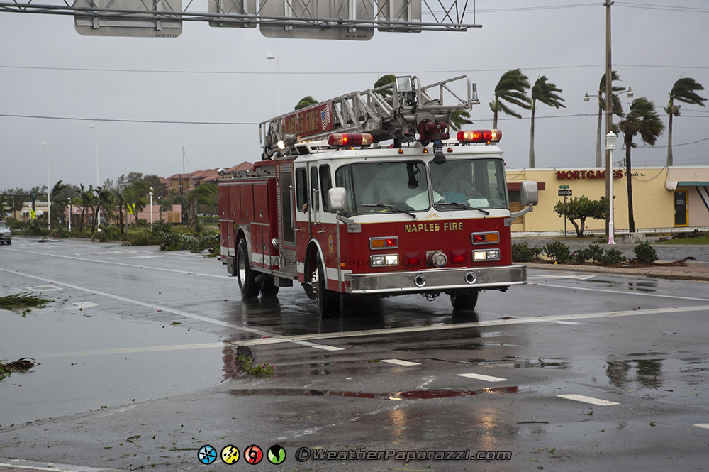
It was soon apparent that we needed to switch up video from documenting the hurricane to documenting the aftermath of the hurricane before the area was locked down by the law enforcement. Were got back to 5th Avenue where we started to see people driving around the debris covered roadways in what was left of hurricane Wilma.
Hurricane Wilma was now pretty much in the history books for southwest Florida as the sustained winds were barely 25 MPH with higher gusts up to about 60 MPH. As the winds died off, a lot more people were coming out to see the damage caused by Wilma and driving through the flooded roadways along Highway 41 in Naples, FL. I can’t blame them because I was there from Minnesota to see what was happening.
After driving around a few blocks, all the damage looked the same. It was downed trees, damaged roofs and broken road signs everywhere. The low laying areas did have flooding but it was nothing compared to the surge that happened in the Florida Keys. The cell phones were still working and I called my friends at the Celtic Ray Pub in Punta Gorda to ask what happened up there and I was told to come on in for a Pint and Dinner since everything was fine in Punta Gorda, FL.
The damage caused by Wilma to South Florida was significant but it could have been a lot worse if the storm stalled out over the state like Hurricane Frances did last year. Thanks to the cold front, Wilma was now picking up its forward motion speed as it crossed Florida and into the Atlantic by this afternoon.
One nice treat to everyone affected by Hurricane Wilma in Florida was that after the storm, it was sunny and almost downright cold thanks to the cold front. Anyone that was with out electricity for the next few days would not have to worry about trying to keep cool since the temps were in the 60s and 70s.
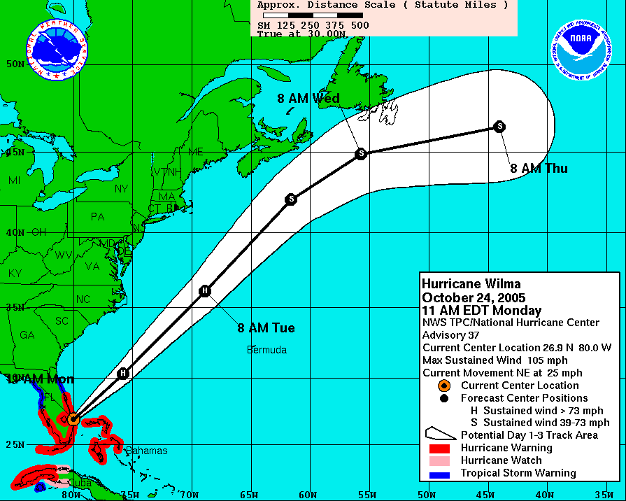
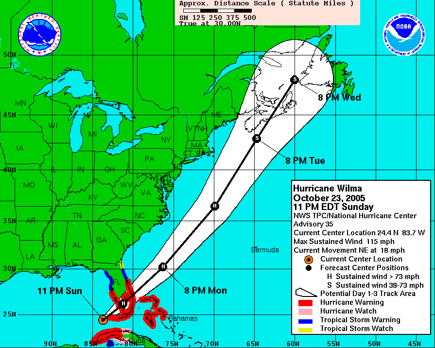
NHC 11PM Hurricane Wilma Forecast 10/23/2005
For more information about the NHC Forecasts, go to this website.
http://www.nhc.noaa.gov/archive/2005/WILMA.shtml
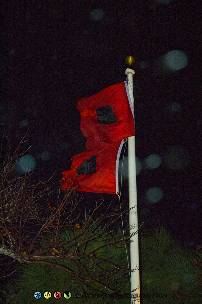
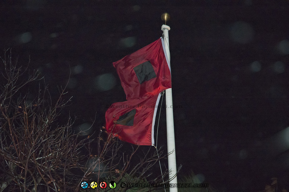
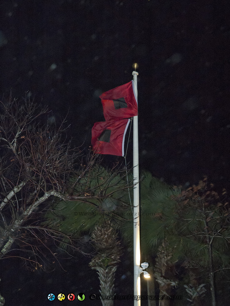
Below are the still photographs I took during Hurricane Wilma on 10/24/2005 on Marco Island and Naples. The nighttime photographs are from Marco Island and the daylight photographs are from Naples Florida.