
The historic hurricane season of 2005 was still fresh in everyone’s memory when the 2006 tropical season started with Tropical Storm Alberto on June 10th, 2006
The first forecast from the National Hurricane Center (NHC) was looking like the armpit of Florida for a strong tropical storm or maybe a hurricane in the next few days.
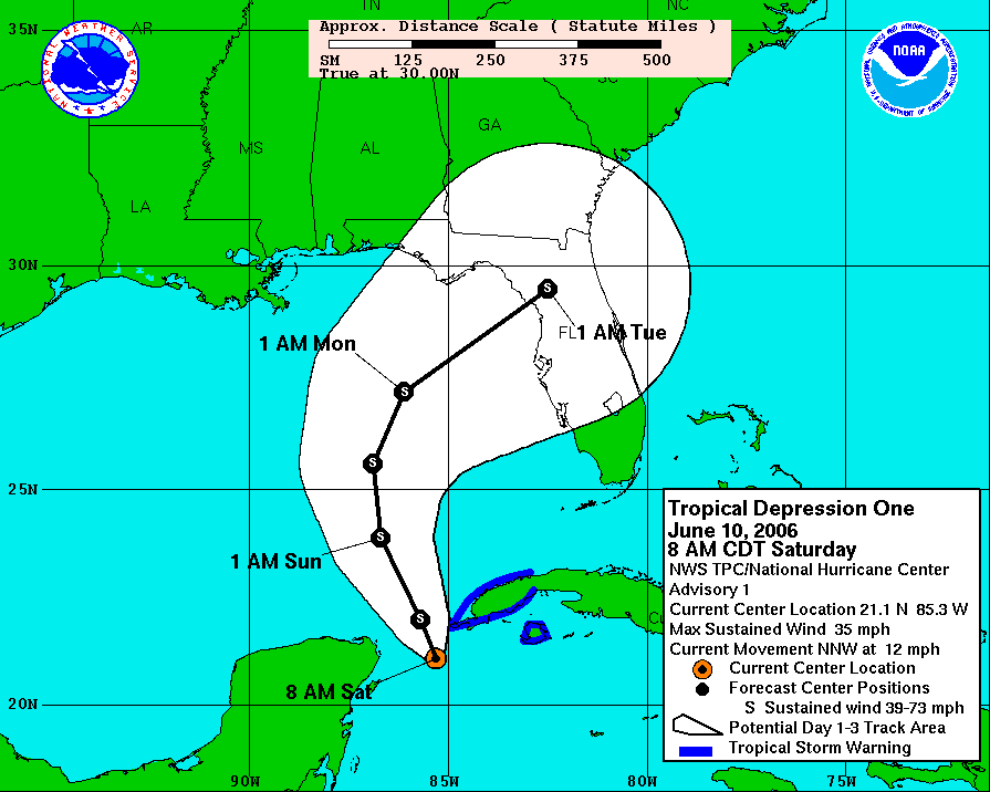
I started making plans to fly into Florida to chase Alberto if the storm became a hurricane and I was not so sure about this storm but I figured what the heck, it’s a tropical storm. I had one heck of a winning streak when it came to chasing tropical systems over the last two years and thought what the heck, lets chase another hurricane when the 10:00 a.m. NHC forecast came out.
To add fuel to my fire to fly into Florida to chase what I thought was going to be Hurricane Alberto, my friend and BNVN Weather Paparazzi Brian Dombrowski was shooting footage for BNVN in Sarasota Florida of some insane flooding.
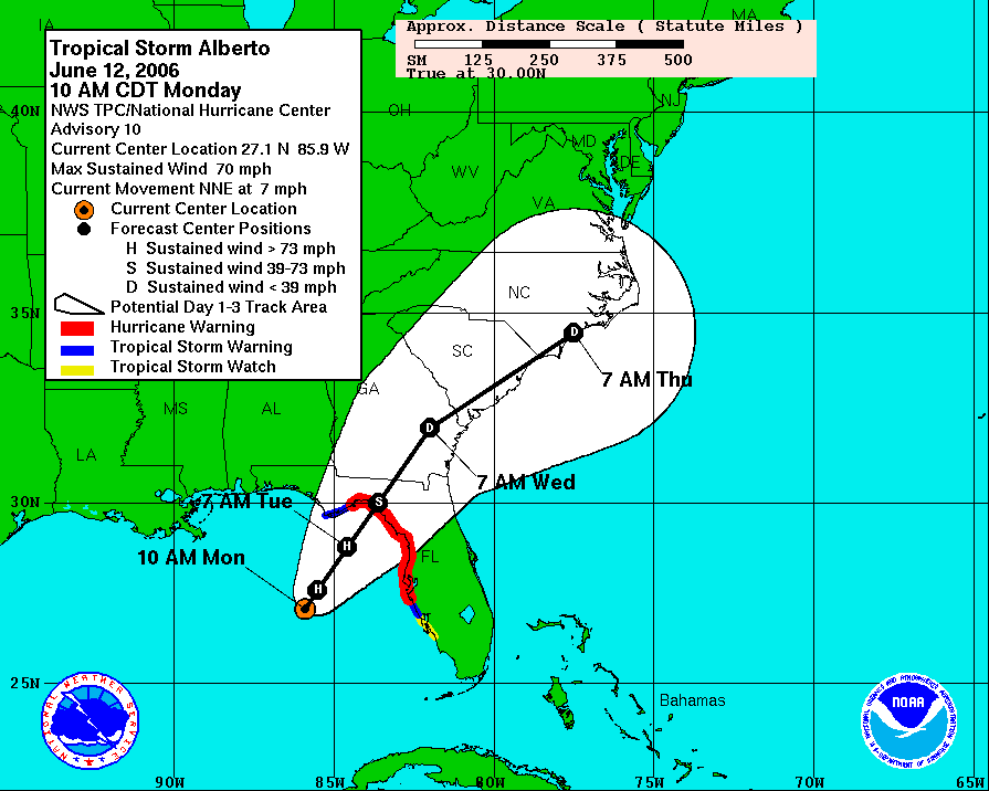
So with one more forecast from NHC at 4:00 p.m. showing that Tropical Storm Alberto was just about to become Hurricane Alberto with sustained winds at 70 MPH, I got on a flight to the nearest airport that I could fly into with such short notice, Atlanta, GA.
I got into Atlanta, GA on the last flight out from Minneapolis, MN for the night and had a 435+ drive ahead of me down interstate 75. The first stop was to Walmart to pick up supplies that I could not bring on the flight with me such as food and water and then it was off to Valdosta, GA.
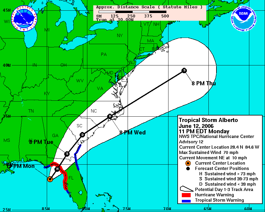
My hopes were high as the 11:00 p.m. NHC forecast came out saying “A FORECAST OF ALBERTO POSSIBLY REACHING HURRICANE STRENGTH BEFORE LANDFALL APPEARS TO STILL BE IN ORDER.” Needless to say I was pretty tired with only getting a few hours of sleep on the flight into Atlanta but this made me wake up fast. I was on track to intercept my ninth hurricane in less than two year’s.
I drove as fast as I legally could down Interstate 75 with my first stop in Valdosta, GA. The outer bands of Tropical Storm Alberto were dumping heavy rain on the city and I figured what the heck why not stop and shoot some footage. Valdosta, GA was the last major city before going into the target area which is pretty sparsely populated.
The rain was pretty heavy but that gut feeling forecast was telling me, eh, this just is not happening yet. The forecast models were show it could happen but what I was seeing in Valdosta, GA was just rain.
As I drove south out of Valdosta, GA I continued to look at the forecast and my fears of a bust were starting to come true. The forecasts models were starting to back off the possibility of Alberto becoming a hurricane. I decided I would make the best of it and head towards Panacea Florida to start out with since it was in the northwest part of the target area and then just work my way back east on Highway 30 and then to highway 98 towards Steinhatchee, FL.
I got into Panacea, FL just after sunrise and the forecast stilled showed the center of Tropical Storm Alberto just off the coast of Florida so I still had time to scout out locations.
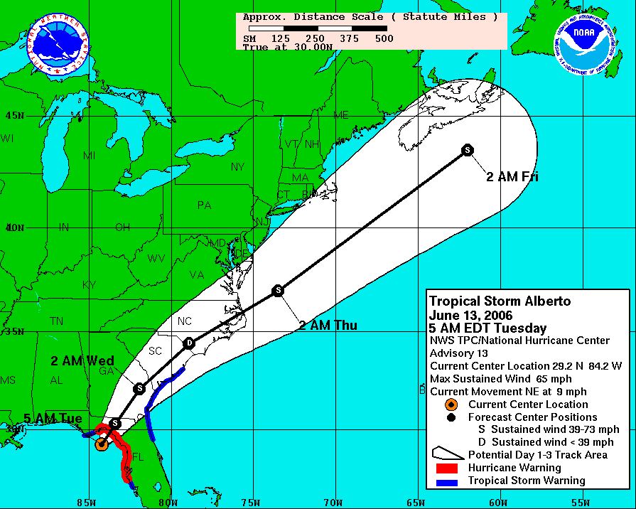
The 5:00 a.m. NHC forecast showed that the max winds of Tropical Storm Alberto had dropped down to 65 MPH and the eye of the storm was heading for one of the most unpopulated areas of the southeaster part of the United States.
I talked to Brian Dombrowski and he was heading up to Steinhatchee Florida since it was a zoo in Cedar Key, FL and there was not much happening down in Cedar Key.
Brian and I met up in Steinhatchee Florida where the worst of the storm was forecasted to hit but now it looked like the worst of the storm was not going to be that bad at all. By 11:00 a.m. the maximum sustained winds of Tropical storm Alberto were now down to 50 MPH and the storm was really falling apart pretty fast.
The lastest NHC forecast said: AT 11 AM EDT…1500 UTC…THE HURRICANE WARNING IS CHANGED TO A TROPICAL STORM WARNING FOR THE GULF COAST OF FLORIDA FROM BAYPORT NORTHWARD AND WESTWARD TO THE OCHLOCKONEE RIVER. ALL WARNINGS SOUTH OF BAYPORT ARE DISCONTINUED.
My long successful streak of intercepting hurricanes had ended and we were in a pretty remote area of Florida that was not being hit with what was left of Tropical Storm Alberto in Steinhatchee. Brian and I made the best of it and shot a lot of footage as the winds reached their peak for the area.
Intercepting hurricanes in this part of Florida is not like on the east coast of Florida. Simply put, there is nothing over on the northwest coast of Florida until you are just south of Tallahassee, FL and areas to the west of Tallahassee. In the armpit of Florida, there are no coastal roads to drive on to see the Gulf of Mexico. This area is about as “Deep South” as you can get and as remote as some places as northern Minnesota in the Arrowhead along lake Superior and into Canada.
Brian and I were able to shoot some decent video in Steinhatchee, FL. Below are four videos from our BNVN Tropical Storm Alberto Collection that shows the worst of Alberto at landfall.
After hanging out with Brian for a few hours in Steinhatchee, FL, we parted ways and he was on his way back home to Sarasota, FL and I headed back up to Tallahassee, FL.
I figured what the heck; I would shoot a video in Tallahassee, FL to document the weather condition in the state capital. This footage was shot down the street from the capital and pretty much sums up what Tropical Storm Albert was, a rain storm that came in on the heals of a historic hurricane season and head everyone on edge then turned out to be nothing to worry about.
After staying up all day and pretty much not seeing anything really outstanding as far as spending all this time and effort to fly down to Florida and take up five days time to put towards what turned out to be just a weak tropical storm, Alberto for me was a bust for hurricane chasing but the best case for the area since nothing happened.
The day after Alberto on 6/14/2006 I was recovering in Tallahassee from the chase and being up for so long. I slept for at least 12 hours in the hotel and surprised that they did not try to bust the door down to see if I died.
Early the next morning on 6/15/2006, I left Tallahassee Florida for Atlanta to fly home. On the way to the airport I stopped by The Weather Channel to say hi to all the people who talk to all the time on the phone but don’t get to see since my I live in Minnesota. I didn’t have long to hang out with them but was fun to stop in and say hi for a few minutes.
When I made it home on June 15th, I was still pretty burned out from the chase, more like a mental basket case after staying up for insane periods of time, crazy travel and then finding out a broke another very expensive camera. Unfortunately I ended up taking out my frustration on a very good friend of mine who was always there for me when life got tough and I messed up.
The cost of chasing can be high sometimes and it is really like chasing an addiction. One must remember as a chaser, there are people around us that really don’t care about the weather but they care about you. When you lose grasp of that fact and you put your chasing in between others and yourself, you are no different than some drug addict.
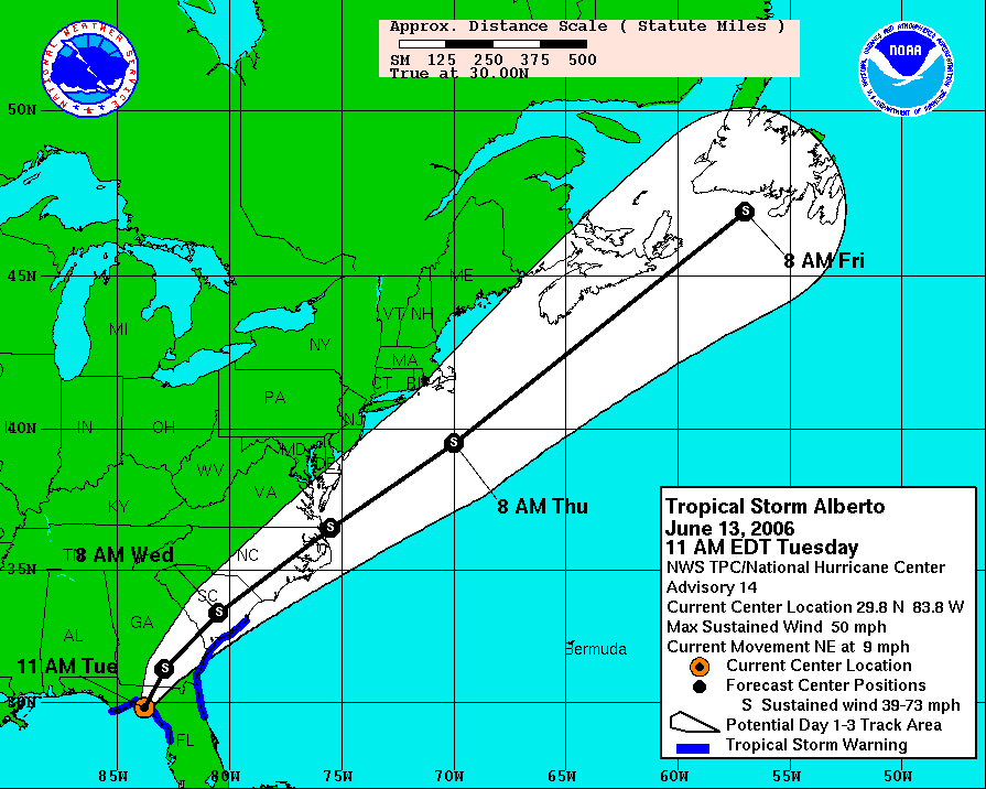
For more information about the NHC graphics and forecasts, visit these links.
http://www.nhc.noaa.gov/archive/2006/ALBERTO.shtml
http://www.nhc.noaa.gov/archive/2006/graphics/al01/loop_3W.shtml