
I have been getting asked by a lot of people if I’m going to chase Tropical Storm Fay, and the answer is that if it becomes a hurricane I might but it’s looking like crap right now. Last night Tropical Storm Fay’s pay took it along the length of Hispaniola (Haiti and Dominican Republic) and it barely survived the Journey over the island.
Right now the forecast track is all over the Map. Last night it looked like it was going to hit the upper Gulf Coast like Hurricane Ivan and Hurricane Dennis did back in 2004 and 2005. Now it’s looking more like Tropical Turd Ernesto from 2006 and TS Fay is almost on the same track as that POS storm Ernesto. Why beat down TS Ernesto? Simple because someone jumped the gun in my opinion and upgraded it to a Hurricane for a brief period of time when it was in almost the same place as TS Fay is now. and everyone started to freak out because they were still in the aftermath of Hurricane Katrina. The funny part is that Tropical Depression Ernesto mad landfall on the one year anniversary of Hurricane Katrina so everyone was in a panic that it could be a repeat, and then it came in as nothing…
Here is the latest Satellite Image and track for Fay from 1715 and 1815. Fay is not looking that great yet.
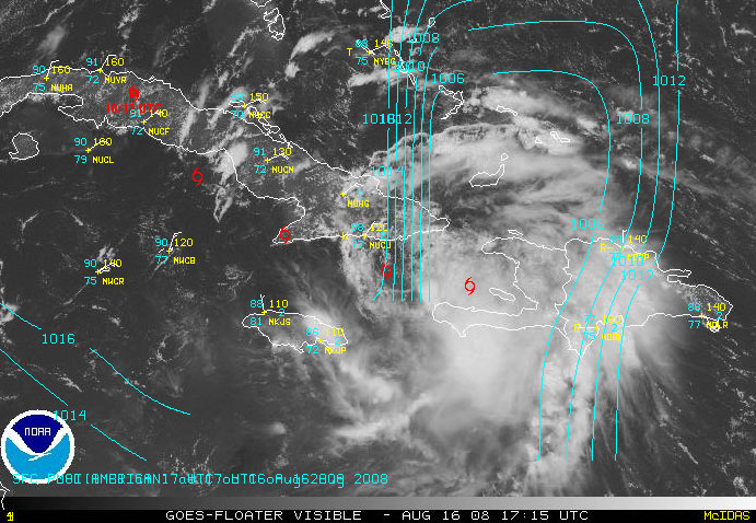
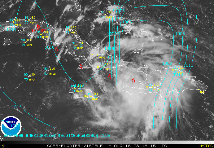
Now that the center of Fay is over open water between Haiti and Cuba it is hard to say if Fay will regain any strength before making landfall over Cuba and the big question, will Fay make landfall over the mountainous area of Easter Cuba which could destroy her.
Below is a hurricane forecast track map from Weather Underground http://www.wunderground.com
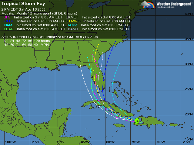
As you can see, the forecast tracks are all over the map and the big question is where will it go and where will the Right Front Quadrant (RFQ) go? The RFQ is the strongest part of the storm.
Here is the 2PM NHC Forecast.
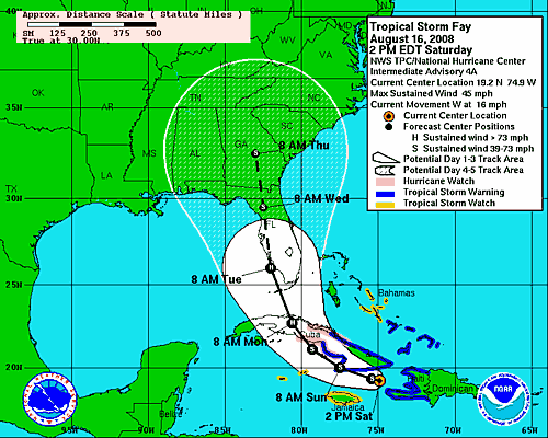
As you can see, NHC has the forecast center line track moving over the Lower Keys during the overnight on Monday and hitting the Naples Florida area to Fort Myers FL area on Tuesday Morning. But if you look at the Weather Underground forecast tracking plots above, this thing could hit Miami and leave Naples in the dust or it could miss Florida altogether.
The GFDL Model which I tend to lean more towards is showing that it would miss Naples and hit the Miami area and ride up the Gulf Stream to the Carolina’s. Like I said before, the computer forecast models are all over the Fn Map. If the GFDL is right, then later this week it will be a real hurricane in the Carolina’s but if the GFS forecast model is right, I could be in Florida on Tuesday Morning filming in Fort Myers with Brian and Chris.
Hurricane forecasting is much easier when the damn storm has already formed before it makes landfall and not as it makes landfall.