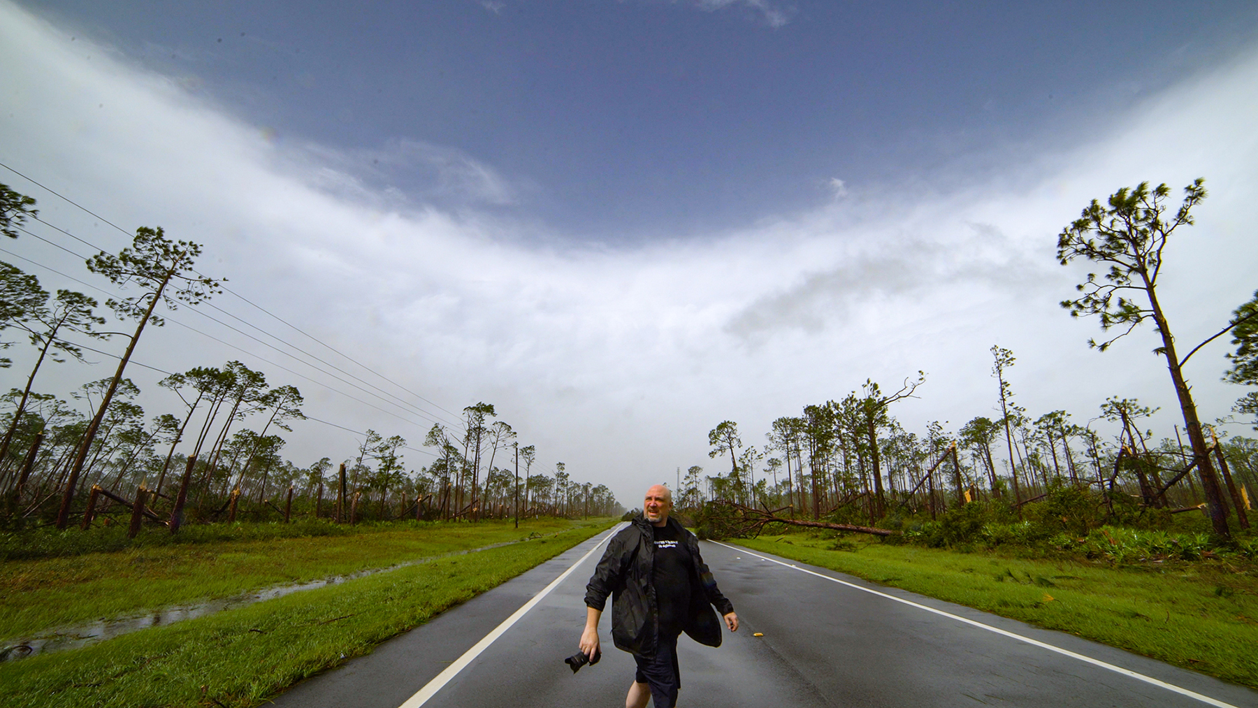
Still working behind the scenes on stuff.

I know is sounds like a broken record but seriously, I’m working on a TON of stuff behind the scenes that is taking a lot longer and is a ton of work.  The YouTube change over is well underway with almost 1500 videos on the BNVN Channel http://www.youtube.com/user/bnvn1 

Also working on the new photo gallery for this page and the whole overhaul of this page.  It’s a ton of work but its all coming together and hope to have it completed in the next week.

What else is happening?  Getting back into flying and just passed my First Class Medical exam this week.  Now I just need to refresh on regs and get the Bi-Annual flight review taken care of and then keep the flying current. 

Well I better get back to work on the huge stack of stuff.  Hoping to get the new BNVN site up and running as well as the new BNVN site by the end of the month.

Another new video on YouTube

Still working on the YouTube swap out and some other exciting new stock photo and stock video stuff for my personal page as well as for the BNVN page. 

Just uploaded another new video to YouTube of some stock hail footage that Tony shot this year.

Various large hail clips while storm chasing in Colorado during the 2010 season.

This footage is pretty insane.  If you want to see a wide range of insane hail, check out this footage.

Update on the rebuilding of BNVN and Weather Paparazzi

Lot’s of cool updates finally able to announce. I’m in the process of doing the updates and transfers but I have been moving all the BNVN footage to our new YouTube Director Partner channel. I’m still working on the transfer of descriptions but right now the BNVN1 YouTube channel has over 1400 videos on the channel. Yes, I said over ONE THOUSAND and FOUR HUNDRED videos on YouTube.

I also uploaded the Katrina Project that Chris and I put together. This was going to be used as a B-Side project for a hurricane project for last year or this year but nothing happened here in the USA. So if you want to watch the DVD project on-line, check it out below.

Hurricane Katrina DVD Documentary, from Miami to New Orleans and Biloxi.

Right now I’m working on the new photo gallery setup and the new video gallery setup for BNVN and for my personal site here. As soon as I get all the stuff behind the scenes edited together and put together, I’ll be launching the new sites in the coming weeks. So stay tuned, were launching a ton of new stuff that is going to rock.

mad crazy editing.

As the project comes down to the wire, I’m doing some mad crazy editing to get it finished up by Tuesday.

Tonight’s project, Fit 3 hours and 49 minutes of video in to 35 minutes of space and make one hell of a story.
If anyone wants to see the project rough edits, let me know and I will send you the link. This is a limited editing proofing thing to get feedback on the project from you the viewer.


9/19/2010 Bermuda, Hurricane Igor hits Tobacco Bay

Hurricane Igor has weakened to a Category One storm but the large waves that were generated when Igor was a very strong Category Four Hurricane are hitting the eastern side of Bermuda this afternoon as what is left of the center of circulation is passing off to the southwest.

BNVN Weather Paparazzi Chris Collura just shot this amazing footage from the Eastern tip of Bermuda in Tobacco Bay of huge waves slamming into and even up and over the coast line and a roadway.

The footage shows large debris flying up in the air as the waves slam into the coast line near the roadway.

Chris is back out shooting more footage and will have another video uploaded if possible later this evening if the power remains on in his area of the island.

9/18/2010 Bermuda Pre Hurricane Igor Footage
9/19/2010 Bermuda, Hurricane Igor hits Tobacco Bay
9/19/2010 St. George Bermuda Hurricane Igor Extreme Conditions

Working and off Facebook

One of the reasons that this site has been slacking for month is due to the time I put towards Facebook and updating and pretty much screwing around on Facebook and wasting hundreds of hours this year on it.

Well, I sat back last week and said WTF, WHY?  I have this website that really needs my attention and the BNVN website that needs updating and new videos posted to it.

Both of my sites have RSS feeds and I have Twitter so why the hell was I wasting so much time on Facebook?  Don’t know but I quit Facebook for personal stuff and will only have my Fan Page for a prescience on Facebook for BNVN and people that might see me on TV and who use Facebook.

I’m working on this site and working to get the Twitter feeds on the site.

or

http://www.twitter.com/stormchasingvid


So if you were a friend on FaceBook and wondered WTF happened to me on what I love to call Crack Book, I’m off of it and spending time working on my webpages, not wasting time on their website.

Hurricane Earl update

Looking at the tropics, I waited until this morning to call the “go / no go” for the Hurricane Earl chase.  While I would love to go intercept land fall of a major hurricane again since it’s been since Hurricane Gustav in 2008 that I was in the tropical systems, Earl is not going to be the storm to chase.

Reason’s why, the eye or center of Hurricane Earl is now on several computer models forecast to remain way off shore.  The area of interests to serious hurricane chasers is the right front quadrant of the hurricane where the most violent winds are.  This area will be nowhere near land as it passes by the east coast until it moves up into Canada. 

Most major areas of impact in the United States such as the Outer Banks of North Carolina and the Cape Code area of Massachusetts’s are well removed from the center and the latest forecasts show that the storm passage will be during the overnight hours where you won’t be able to see much of anything.  Sure their will be some waves and rain, but it will not be a major system that will do much damage to the area’s the media is hyping up right now.

So with no landfall until the system hits Canada this weekend where it will have weakened significantly by then, I’m sitting this storm out and waiting for the next system, Tropical Depression Nine (TD9) that formed this morning off the coast of Africa.

6/28/2010 Blog Update On Stuff

It has been a while since I updated my personal site so here is a run down. 

I’m working on updating the page so I have been posting updates on my FaceBook.com fan page.

http://www.facebook.com/pages/Doug-Kiesling-Photo-Video-Fan-Page/220869651698

I went storm chasing this weekend around central Minnesota and got on a couple of crazy storms.

On Friday night we caught the storms south of Saint Cloud, MN

6/25/2010 Debris shorting out power lines footag

On Saturday, we ended up chasing another storm in southern Minnesota around Lyon County near Marshall, MN. 

6/26/2010 Driving in high winds and heavy rain B-Roll stock footage.

On Sunday we went the the air show in Saint Cloud, MN and watched some pretty sweet planes.  I have not posted the photos here yet since I’m working on the site update but the photos are on the Facebook fan page.

6/17/2010 Storm chase in Pine County, MN

Just getting caught up after an insane couple of days.

Just the short version here.  Been working on http://www.BNVN.com stuff and working behind the scenes to finally update this site.    Thursday I had plans in St. Paul from 1:30 p.m. to 4:00 p.m. and these plans could not be changed and were setup weeks ago.

Once I was finished I was able to get out to chase and ended up heading out west of the metro area and followed the line of storms up north from the Howard Lake, MN area up to Monticello and ended up in Pine County, MN where the tree’s made it impossible to chase.  I swore that as soon as I got to the St. Croix River, I would stop since I was not going to try and chase into Wisconsin.

I did end up shooting footage and here is the video:

6/17/2010 Pine City MN Tornado Damage Video

Pine County, MN which is south of the city of Duluth, MN, a violent tornado hit the area just east of Pine City, MN along the Minnesota and Wisconsin boarder. The tornado injured several people and destroyed one home and damaged another along Highway 70.

Explosive Storm Sewer from Minneapolis, MN on 07/03/1999

Back in July of 2004, we shot footage of an explosive storm sewer on Interstate 35W and 35th street in Minneapolis, MN.  

7/11/2004 Storm Sewer System Backing Up Video.

Since then we have been getting requests for another video that was shot by a traffic camera in 1999 of the same thing happening and causing an accident.  After a lot of searching, we finally found the footage. 

7/3/1999 Traffic Camera Catches Storm Sewer Backing up 50 feet in the air

This video from 07/03/1999, from the traffic camera on Interstate 35W and 35th Street catches the explosive storm sewer happening several times over a few minutes and even has the accident caught on tape where a pickup truck drives into a massive storm sewer cover that was blown off the opening. The storm sewer would get large amounts of air trapped in the system during heavy rain causing it to push the water back up the storm sewer system and exploding straight up in the air like a geysers. 

I also found the video form the tower camera that shows me driving up to the exploding sewer on 7/11/2004.

7/11/2004 Traffic Camera Explosive Storm Sewer Flooding