I finally got around to working on the compilation edit of all the ridiculous Car Crashes and Winter Weather “Slip and Slide”.
This is years of my best of the best footage of numerous car crashes, spin outs, stuck cars, and even some guy falling on his ass on the Nicollet Mall in downtown Minneapolis.
As far as I know, nobody was killed in any of the accidents in the crashes in this video. But a lot of ego’s were probably bruised 🙂
All footage shot while working freelance for various television news networks.
Contact StormChasingVideo.com to license the clips in this video.
And now for the next big adventure in our lives. Come Valentines Day 2016, we are adding a new member to our family.
Hello World, Meet LauraFuture storm chaser in the works
Yeah, I have already heard all the jokes from my friends about now they know why I was not out chasing all the garbage storms in May and stayed home to do something else. Well yeah!!!
We are so excited about having a baby and adding to the family. Since we are older, the medical staff was worried about everything at first but so far all of the tests have come back showing were in our early forties going on 30.
Neva is still pretty worried about everything and we will never be totally 100% out of the woods until the baby is born but right now, everything is on track for a Valentines Day birthday.
One thing we did learn that put me at ease but really did not help Neva is that we were told by one of the medical staff at our last visit that her “Morning Sickness” was actually a good sign for the baby being healthy. I joked about it being an all day sickness and learned as the father, in this to situation to pretty much shut up because the line of communications was between the staff and the Mother, I was just there to take notes and make sure she does what they told her to do for her and the baby to stay health.
Since Neva said I could be as descriptive as possible within reason for my blog, I will make this joke. What is it like with living with someone with morning sickness that is actually an all day sickness? What does it sound like? Well from the TV Show South Park. This is the only thing I could come up with what I have been hearing for a couple times a day for the last 2 months… A Dying Giraffe…
Morning Sickness?
Otherwise, life has been pretty normal, just have not been able to chase more then a few hours from home now since I have had to be on call if something happened with the baby.
The funny thing is all of our friends and family have been telling us that the Morning Sickness should go away in a couple weeks. They have been saying that for week’s and still everyday I hear the Dying Giraffe.
The best quote Neva told me to talk about is what the Doctor said. He said when he used a devise to listen to the babies heart, “You are totally pregnant”.
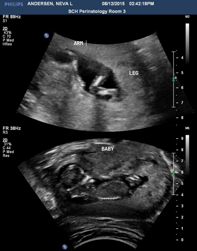
So the highlights for the past month, seeing several tornadoes and some insane storms close too home, finally able to announce the news about the baby and the best thing ever was missing the storms on 8/12 way up north. Wait, what, missing a storm was the best thing ever you say? Yes, because in the ultra sound images above, our child waved and said hello to us.
8/13/2015 Central MN Overnight Lightning & Hail B-Roll
Severe storms impacted central Minnesota last night and early this morning with large hail and vivid lightning. It was another great opportunity for a local chase.
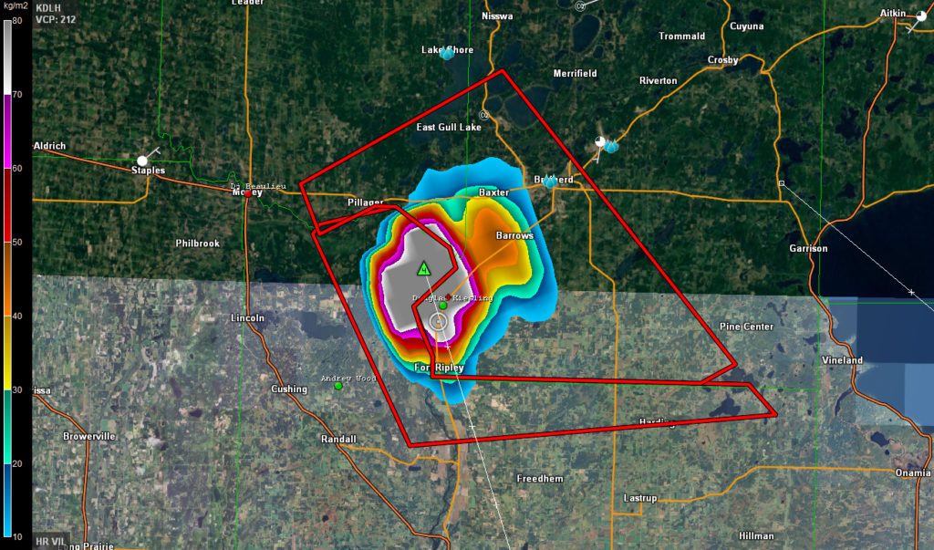
While I was busy during the day and was not able to make it up north for the chase in the afternoon, I was able to make it up for the chase in the evening. Before I made it to Brainerd, MN, the VIL or Vertically Integrated Liquid was in the extreme range on radar and it looked like I was in for some fun. The down side was that it was going to happen after dark and no city or town would be in the path of the core.
8/13/2015 Hail Core VIL
In the image above, if you right click on it and view the full size version, you can see that a hail core with possible 4″ diameter hail was right on top of me. Knowing the storm setups up here and this time of year, I doubted the radar data was accurate. When the hail core hit, I was right, it was extremely heavy rain and golf ball sized hail. Still pretty intense hail but not softball size.
I played with this storm for a while and then drove home to Saint Cloud, MN where I waited for the next round of storms with some pretty vivid lightning. The lightning in the video is pretty intense and looks great in real time in the footage.
8/9/2015 Kingsbury County, SD Extreme Winds / Storm Damage B-Roll
What a insane chase day. With Category One Hurricane Force Wind Speeds, the storm that I was on in Kingsburry County, South Dakota, it was one hell of a storm. Footage of the severe storm that hit Kingsbury County, SD with a possible micro-burst or downdraft picking up a travel trailer across the road from me and throwing it over 50 feet into a farm field. There were no drag marks in the bean field.
Another great chase day where we saw 5 different tornado touch downs from the same location just south of Hawick, MN. Not bad for someone that does not chase anymore according to others that think you have to chase all the garbage to be a real chaser when forecasting is the key to not wasting your time. I think I earned a glass of the 18 year old The Macallan, that I’m sipping on now.
Today started out where I had to take care of some things around home and at the office again so I got a late start but the target was in my back yard. I was still at the office loading up gear when the first tornado warning was issued. The storm was only 30 minutes to my west so it was just a matter of pick up the cameras from the house and hit the road.
I met up with the new kid, Riley just north of Green Lake and we headed to the east side of the lake to watch the storm since there are very few places in the area that have a decent view for chasing. After seeing how the inflow was still surging into the storm and another updraft was moving north to the tornado warned storm, I told Riley we needed to move and we ended up in an area just south of Hawick, MN where I knew there was a spot we could park and see the storm and wait for it.
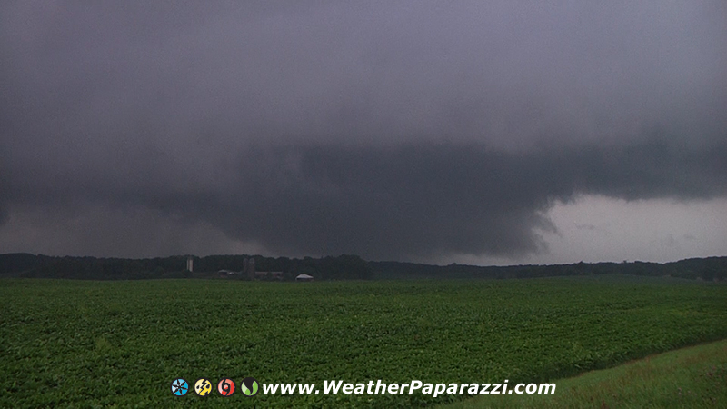
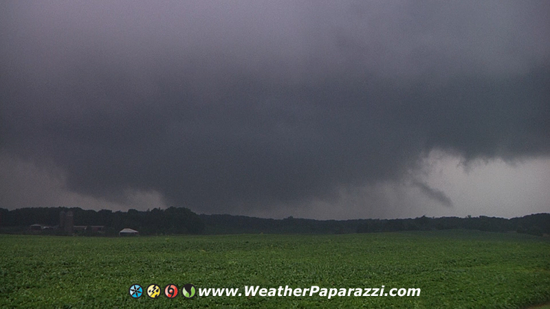
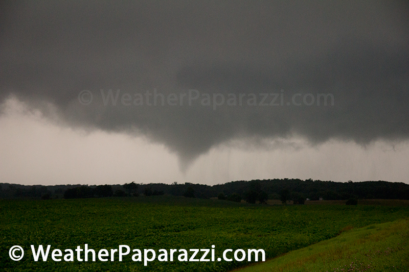
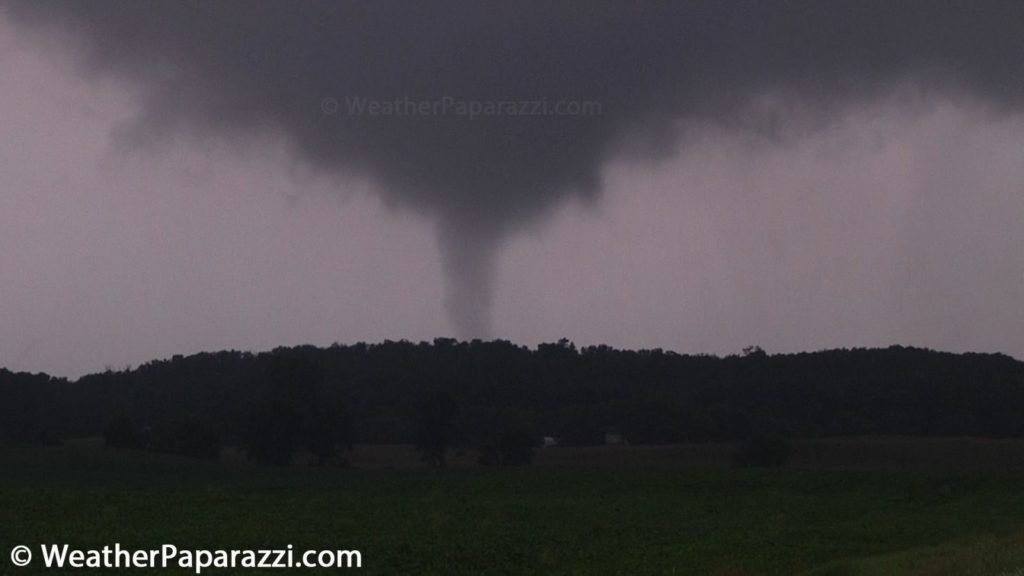
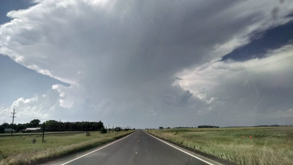
A few minutes later we were watching this in the sky with an almost perfect view of the horizon considering the area was hills, trees and ponds.
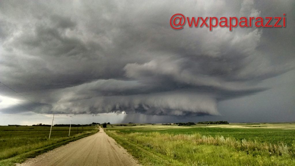
Now we were in perfect position just south of Hawick, MN watching the wall cloud and meso with intense inflow and rotation a few miles to our north. I know, why didn’t I get closer? Simple answer is if you got closer you were stupid because of the tree’s and lack of visibility with this storm. This storm required some distance from the meso to be safe and to see what was happening to get some decent footage and photographs.
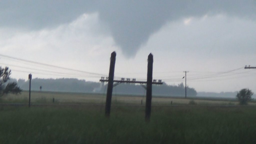
It did not take long for the storm to pulse back to life and with in a few minutes, it dropped what I can confirm in the video, 4 new tornadoes near Hawick, MN. They only lasted from a few seconds to a few minutes but it was an amazing sight if you were a chaser but I heard that a farm did take a hit from the storm.
It was a Red Sky In The Morning for the Twin Cities metro area as the drive in to town was filled with lightning and heavy rain. Once in town, commuters were dealing with the heavy rain on the Nicollet Mall.
Clip 1 Roof camera with lightning on Interstate 94.
Clip 2 Pre dawn with the red sky along with a rain shaft and flashes of lightning.
Clip 3 Pov shot on Interstate 94 with reddish orange sky and lightning
Clip 4 POV and lightning on side road near Big Lake (had to stop and get fuel on the way to Minneapolis).
Clip 5 – 8 Heavy rain on Interstate 94 after sunrise.
Clip 9 Minneapolis skyline on the Nicollet Mall in the rain.
Clip 10 People getting off a bus and opening up umbrellas.
Clip 11 Woman walking with an umbrella
Clip 12 Lots of people filling the camera view with umbrellas
Clip 13 Man standing with an umbrella while waiting to walk across the street.
Clip 14 People getting off a bus in the heavy rain and opening up umbrellas.
Clip 15 Man walking in the heavy rain with out an umbrella and has to cover his bag up with a garbage bag to keep it dry.
Clip 16 Biker in the rain.
Clip 17 Someone walking towards the camera in the heavy rain.
Clip 18 Biker in the rain.
Clip 19 One man puts a bag over his head while the other just stands in the rain and then someone walks up with an umbrella
Clip 20 Woman walking across the street towards the camera in the rain, with an umbrella.
Clip 21 People walking on Peavey Plaza in the rain with umbrellas.
Clip 22 – 23 Traffic in downtown Minneapolis in the rain.
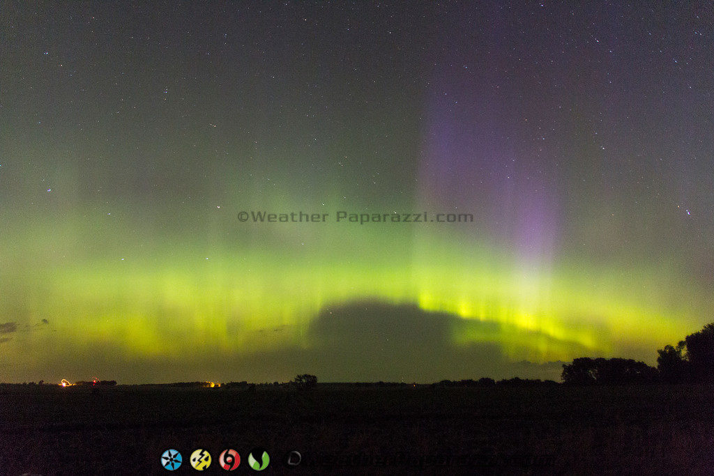
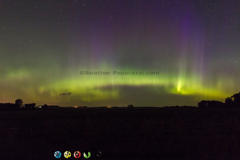
Early this morning I was treated to another wonderful show of the Aurora Borealis or Northern Lights. Below is the video and the photos from what I was able to see.
Wow what a fun day of storm chasing on a great setup in a perfect chasing area in eastern South Dakota. The only down side for the day was my late start from home since I was waiting on a part for the Jeep to fix the vacuum leak.
Once the new purge solenoid was installed, I needed to take the truck on a long drive to test it out and what better way to test it than to storm chase? I headed up to Sauk Centre and then west on 28 and then over towards Sisseton, SD. What was incredible about this chase day was the visibility and how far I could see. When I drove down Highway 28 into Glenwood, MN, I could see the storm forming in South Dakota. When I looked at the map plotted my position to the storm, I was 80 miles away from it and I could still see the base of the storm.
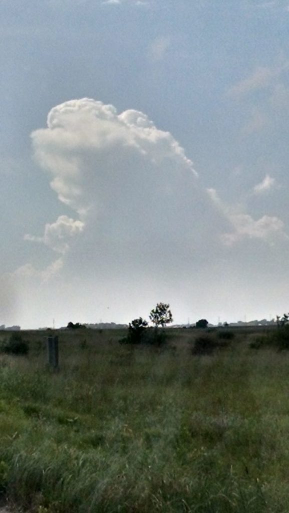
As soon as I crossed over the boarder into South Dakota, the storm became tornado warned and Nick and Amanda were already on the storm and said they were seeing large hail and incredible structure. Being late for the show, I was not expecting to see such an intense updraft on the east side of the storm but this is what greeted me north of Sisseton.
The photo is from my phone and the video and time lapse of this is just intense. I waited around for a while and even talked to a man that lived just behind where I was parked and explained to him that he might be in for some hail but this storm was moving to the southeast and there was a very low chance of his farm getting hit by a tornado, while there was a better chance of the hail, high winds and heavy rain.
After leaving this area I ended up where there were a lot of other chasers on the south east side of the storm and saw that Nick and Amanda were on the west side of the storm avoiding the hail core. Eric Whitehill and I passed each other on the road and talked briefly on the phone and Eric told me that he was avoiding the monster hail. So seeing that this storm was not likely to produce a tornado and only be a hailer, I pulled a card ouf of the “Laubach Chaser Hand Book” and drove into the core. At first I did not see any hail and turned around and headed back east. Upon heading east and ending up back to where the chaser convergence was before, there was nobody around and now the baseballs started falling from the sky.
The most intense part of the day was when Nick and Amanda stopped to say hi after the first hail core hit my truck and moved on. We were checking out huge hail stones when all we heard was CRACK-BOOM and lightning struck a power pole about 100 yards away from us. That was intense!!! We ended up meeting up again just across the Minnesota state line to watch the vivid lightning show and wait out the storm moving off to the east so we did not have to drive in the rain to go home.
Today was one of those great chase days where everything line’s up and falls into place. Upon seeing the first storm fire and a lot of people get what I will call “Suckered” into chasing them up past Fergus Falls in the hills and trees when the second storm I was targeting near Wheaton, MN fired up. I talked to Amanda and Nick who were already in place up there for the cell that was firing and I just hanged back to cover the south side in case the southern cells on the South Dakota boarder fired up.
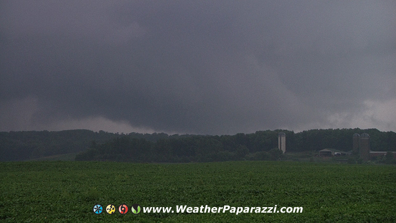
At 4:14 PM, this is what the cell near Wheaton, MN looked like as I was heading towards it.
After making the decision to bail on the southern storms in South Dakota since I was 25 miles from the Wilkin County, storm. I headed up highway 9. In just over 20 minutes the storm grew from a small updraft to a full supercell that was all alone and on the warm front.
After driving another 15 minutes to the northwest, I was watching a perfect wall cloud in the distance and could see the area of rotation.
Soon it looked like this.
7/12/2015 Tornado touching down near Doran, MN
Ok so it Split The Uprights… The tornado lasted about a minute but it was not the only tornado of the day. The hail was not as large as the VIL (Vertically Integrated Liquid) was saying it was since all of the radar’s from the National Weather Service were over 100 miles away and the area is a major radar hole for any data. Yes, that is correct, the Aberdeen, SD, Grand Forks, ND, and Minneapolis, MN radars are all over 100 miles away from the tornadoes today. NOAA really needs to install a radar site up in Alexandria, MN to fill in the gap.
Ok, enough with my views on poor government planning and lack of radar data. I pretty much went off visual data today since I knew the area has the worst data coverage.
Here is the video from today.
7/12/2015 Central Minnesota Tornado & Lightning B-Roll.
And I’m starting a New Tradition. For many year’s it has been a tradition to have a steak dinner after every successful storm chase. I’m bored with that tradition so I’m starting a new one. After every successful storm chase where I go out to see a tornado and I see a tornado, I’m not going to eat a steak dinner. I’ll eat what I want to eat and drink a fine glass of The MaCallan 18. I can get a steak and cook a steak anytime I want but The MaCallan 18 is something that is only for special occasions.
Today was a warm up day to test out the gear before Sundays big chase day. Here is the footage I shot just east of Saint Cloud, MN of the storms near Milaca, MN.