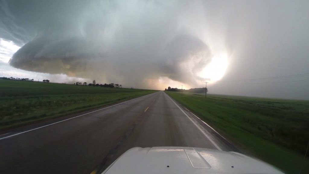
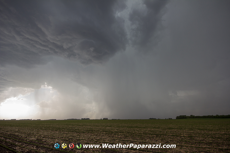
Today was one of those fun local chases where knowledge and skill was what was needed to navigate the rush hour traffic and road construction to anticipate where to be for the best or worst of the storm, depending on your perspective. I pretty much played the north metro from Elk River / Anoka to Maple Grove and Plymouth. I think there will be a lot of hail sales for cars in the next few weeks as a lot of people got stuck in the core on 494 in the north bound construction from 394 to the 94 split on the north side. For the most part the hail was 3/4″ to Golf Ball sized with a few larger stones thrown in the mix to scare you when you hear the heavy THUD as it hits the roof of the truck. I did have one problem today in the hail which is the GoPro stopped recording and then started back up, all on its own in the hail storm. My guess is hail hit the start / stop button on the top of the camera and it shut off then turned back on after hail hit it again.
6/29/2015 Twin Cities Rush Hour Hail Storm
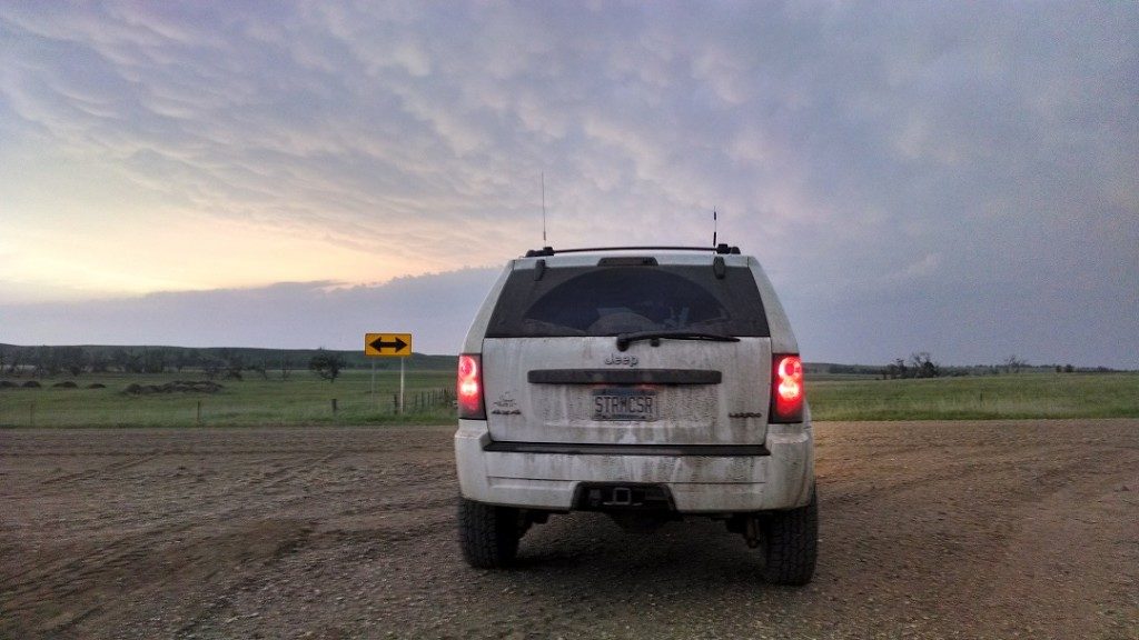
Oh and for the idiot that can’t tell a “Lifted Jeep Grand Cherokee” with oversized tires from a Ford Escape, here you go.
2005 Jeep Grand Cherokee Chaser Ride
Get your eyes checked! I don’t park in the lanes of traffic like that, EVER on primary roads and how the hell was I in front of you when I was over 2 miles east looking back west at the storm what looked more like a micro burst then what was reported as a tornado.
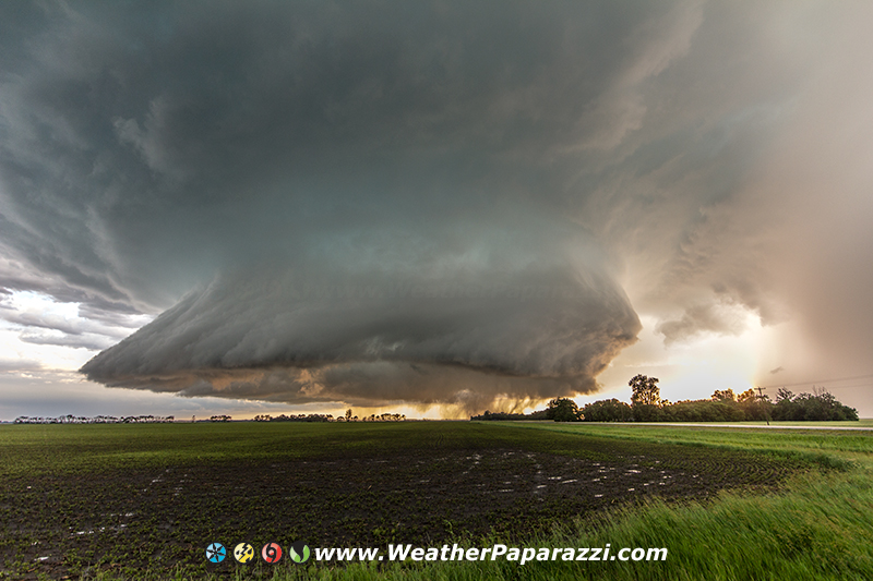
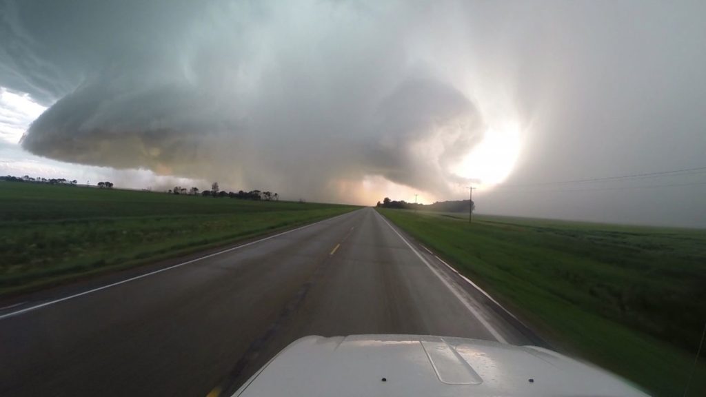
Drove up to Richland County, ND and saw two amazing storms. The first storm put down a bunch of golf ball sized hail and made the roads look like it just snowed. That storm weakened and moved off to the southeast and into western Minnesota to become a mega hail storm but never was tornado warned. I bailed on as it moved southeast of Wyndmere, ND.
I drove north for about 10 miles to the north on highway 18 and intercepted the next storm that was weakening but I had a feeling that it would regenerate and come back to life. Boy did it ever come back to life as it rode the boundary to the east south east.
On highway 18, once again I met up with Riley, who I met a few weeks ago near Benson, MN. This time he had his girlfriend with him. We chatted for a while and kept on chasing until we got on Interstate 29 and then he fell behind. Was cool to see him and finally connect on Crackbook with him. I was wondering what happened to him as I pulled off at the next exit waiting for them but turns out they had some car trouble and had to call off the chase.
As I kept on chasing after waiting a few minutes for Riley to catch up, I drove down Interstate 29 and knew the Red River would be an issue so I opted to head east on 11 towards Fairmount, ND. I saw some chasers parked on the bridge over the interstate that almost became “Road Kill” by several vehicles. If you are going to pull over to watch the storm, don’t do it in the lanes of traffic or on a restricted bridge with a lot of traffic. Another SUV today was parked half way on the road in the lanes of traffic to take photos when there was plenty of space to pull off to the side of the road or in some driveway or farm field entrance. Every year the dumb ass parking on the road gets worse up here.
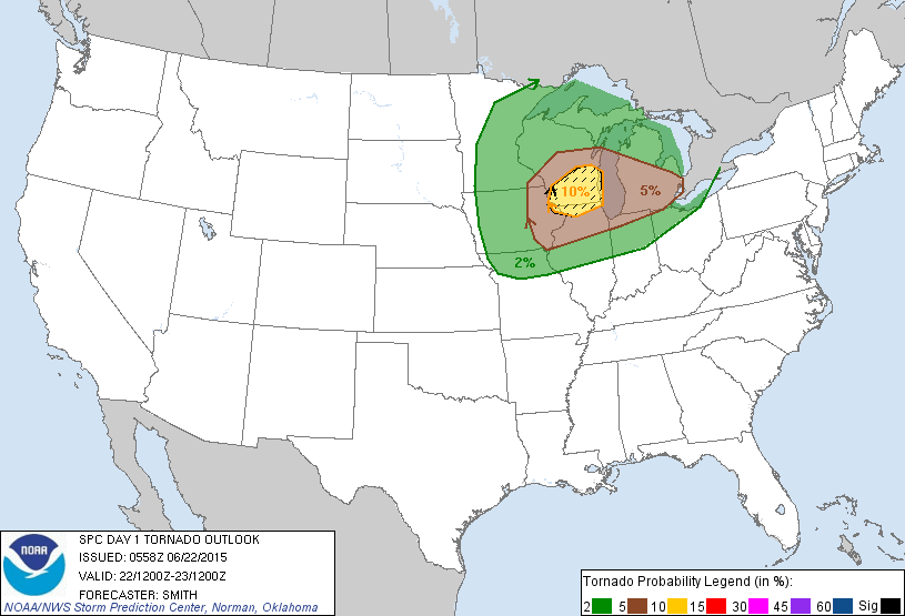
I think I have maybe got 4 hours of sleep in the last day and a half. I’m saying today but in reality it is yesterday that I’m talking about in this post, excuse the really tired blogging 🙂 It all started on Sunday as the Hype Train was getting going for the forecast, which is still today for me but in reality is yesterday, for the area in Southern, IL. The hype was for the 10% hatched forecast tornado area that SPC put out for the area which on paper looks good but doing my own forecast and from experience, looked too good to be true.
SPC Hype Train
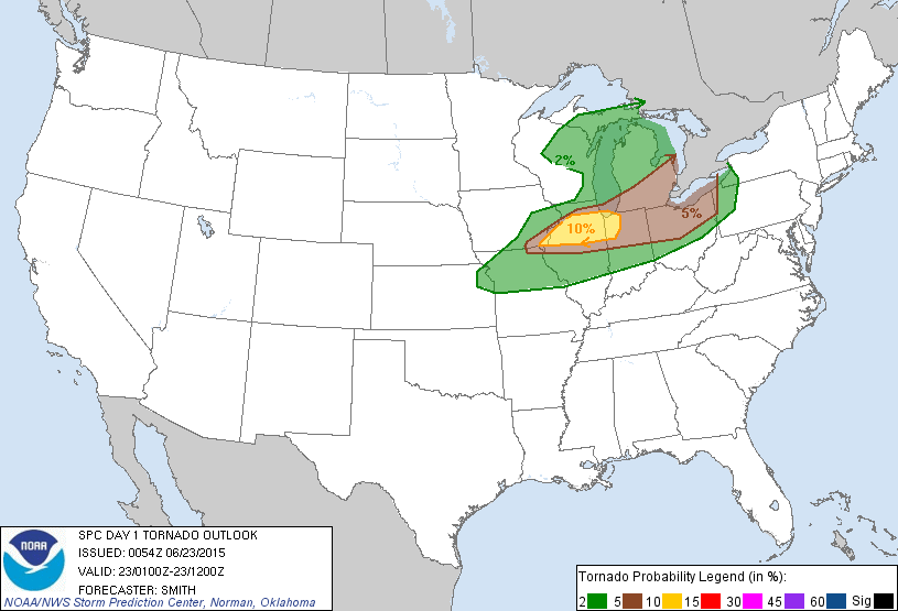
The forecast went from the graphic above to the graphic below.
Forecast falling apart
Now before anyone gets pissy, I’m not bitching about the SPC forecast. The 10% hatched looked to be valid before the monster high speed MCS from the early morning storms this morning, correction, yesterday morning, plowed through southern Minnesota and northern Iowa.
The morning storms really did a number on the forecast but I had a feeling they would and the forecast was also for Wisconsin, which just sucks to chase in anyway, due to the hills and trees. Everything shifted south into Illinois and honestly, I have better things to do then drive to Illinois when I already had a full plate of stuff to document in Minnesota.
First up, today’s, I did it again, YESTERDAYS early morning storms were amazing to watch.
The lightning was just simply amazing and at one point was more like a night club with the strobe effect from the flashing in the sky.
6/22/2015 Madison Minnesota Pre Dawn Lightning
I drove out to Madison, MN which is on the Minnesota and South Dakota boarder as the storms were pretty much just getting going and provided an amazing light show for about half an hour before sunrise. At Sunrise, everything clicked and the storms raced off to the east faster then I could keep up. I drove home and took care of some work until the next big show started up in Iowa and Illinois and worked the desk until I was finally able to take a nap for an hour, only to have Neva wake me up and say the sky looked insane and we needed to go see something Amazing, the Aurora Borealis.
6/23/2015 Sauk Rapids Minnesota Aurora Borealis
A G4 Class Solar Storm with a Kp Index of 8 caused a geomagnetic storm that filled the sky over central Minnesota.
The auroras were extremely bright and filled the sky as they extended over head and moved into the southern half of the sky.
The sight was amazing and we found a couple new spots to view them from just north of town where we could avoid traffic and people coming up to us late at night wondering what we were doing. Also talking to my friends Amanda and Nick who were on vacation in North Dakota and they almost drove back yesterday to chase in the Wisconsin and Illinois mess, they finally got to see the amazing sights I always see living north of the Twin Cities metro area. Amanda has never seen them until this evening and while I was talking to Nick on the phone, all I could hear in the back ground was what sounded like when someone chases and finally sees their first LP supercell with a tornado. Yeah she was happy! Actually they were both happy for blowing off the chase to go for the secondary target and it paid off for them.
At the peak of the Auroras, one thing I noticed was that my cell phone was not working. It kept saying all circuits were busy. I wonder if the geomagnetic storm was hurting the communication satellites.
What about the primary target? One of my best friends in chasing, Chris Collura, got on the tornado in Illinois today and shot some amazing footage. Sorry YESTERDAY. Here is his video.
6/22/2015 Illinois City IL Tornado
Yes there were storms, no I won’t even think twice about blowing them off if there is a chance I have to chase in Wisconsin.
It has been an interesting week to say the least and it was good to wrap up and end it on a fun little chase about 100 miles to the west near Wheaton, MN. While a lot of my crews went to chase the 5% tornado risk in Iowa, I looked at the forecast at 6am and said NOPE. Nick called this afternoon to tell me that even he blew off Iowa and stayed in the Twin Cities. Where there storms in Iowa? YES. Where they worth justifying driving 6 hours south to chase them? NOPE! I’m glad the secondary target worked out but I had to take care of some obligations at home to help Neva out and then at the office so I got a late start and did not make it up to North Dakota but still love chasing in western Minnesota where the area is perfect for chasing.
Not a lot of lightning and the hail was mostly pea size to marble size but being home within two hours after the chase was worth it. Time to get some sleep and consider heading to north central South Dakota later Sunday.
Tonight was one of those weather setups that was just relaxing drive in the country and filled with vivid cloud to cloud lightning in the sky making for a peaceful end to a somewhat stressful day.
I drove down highway 15 from home towards Hutchinson, MN which is about an hour south of the house (and more then 20 miles). It was good to get out and just watch the slow moving storm that was all cloud to cloud lightning. I’m not sure why some storms are like this one where I did not see any cloud to ground lightning strikes but I am not complaining ether since it was a little more safer in my mind but in reality, it was still pretty sketchy standing out under lightning flashing in the sky.
6/14/2015 Hutchinson, MN Lightning At Dusk
I was sitting back watching the lightning and just taking it all in when I realized, maybe I should also setup my still camera. Below are the two shots from tonight that I like the best.
In the first photograph, the lightning reminds me of some of my very early work from 1995 where the structure looks kind of like a a web. Wow, thinking back to that photography from 1995 just kind of made me take a step back and realize that I have been doing this photography and video thing longer then some of the other people getting into chasing, longer then some have been alive. And those days back in the 90s seem like yesterday.
Below is my favorite from today. It only caught half of the lightning that filled the sky but it was close enough to fill the camera with a lot of detail within the cloud to cloud lightning.
Well, it is late and I should get to bed before the sun rises so Neva and I can get the permits for the city compost since we did a lot of yard work this weekend and now the last of the clean up must be done so the yard looks great.
On another note, I really like moving all the blog stuff off of the social media and back to my corner of the interweb stuff. This week I hope that Neva and I can finally pick a date and place for a nice small wedding sometime later this year. As my mom said to use a few weeks ago, “Hurry Up, I’m not getting any younger”.
Yesterday I went on one of the many chases that “rumor”
has it that I never do anymore since it was over 20 miles from home.
The target area for me was well defined days in advance and in an area
that I love to chase in, western Minnesota where visibility is not a
problem with trees.
After helping Neva out with some much needed chores at home with the yard, I took off to drive out west towards my target area that was near Benson to Morris, MN. The storms were just firing up and were looking amazing as I pulled off to a safe parking spot off of the road so as to not block traffic or be in anyone’s way. A Pontiac pulled up and I was thinking great more locals to mess up my audio track on the video cameras. Turns out I had to apologize to some new chasers that showed up that I was kind of rude to at first. I thought they were locals just seeing what I was doing and I was telling them to get out of the area as the radar was showing 2″ hail just off to the west of our location.
We chatted for a few minutes before the rain started and the hail
core was about to hit. I packed up my camera gear. I was heading west
toward the storm when I noticed one small detail, I failed to stop and
top off the fuel tank in Benson before I stopped to document the
lightning. Whoops, I had to turn and head back to Benson for a fuel and
then continue the chase.
After filling up the truck, the radar showed the storm split into two
possible targets. One to my northeast and one to my southwest. The
southwest target looked better on radar and was closer so I took the
closest option. The storm looked decent and at one point the radar
showed some rotation.
In the photo above, the rotation was very high based and before I could get the video cameras ready, the rotation faded away. I was driving south to try and get in front of the storm where I could see it but the dash camera was not able to get a decent view due to the antenna and window frame in the way. This is when I needed a chase partner to film out the passenger side. This storm pulsed up and looked good then within 15 minutes it started to weaken again.
The storm to my northeast pulsed and then weakened a little, only to build bake up and become a beast that moved off to east and it was in a area just south of home. I followed the storm back home but I knew that there was no way I could keep up or even get back into the storm. I was just enjoying the weather and the drive in the country as the temperatures dropped from 98F to 75F.
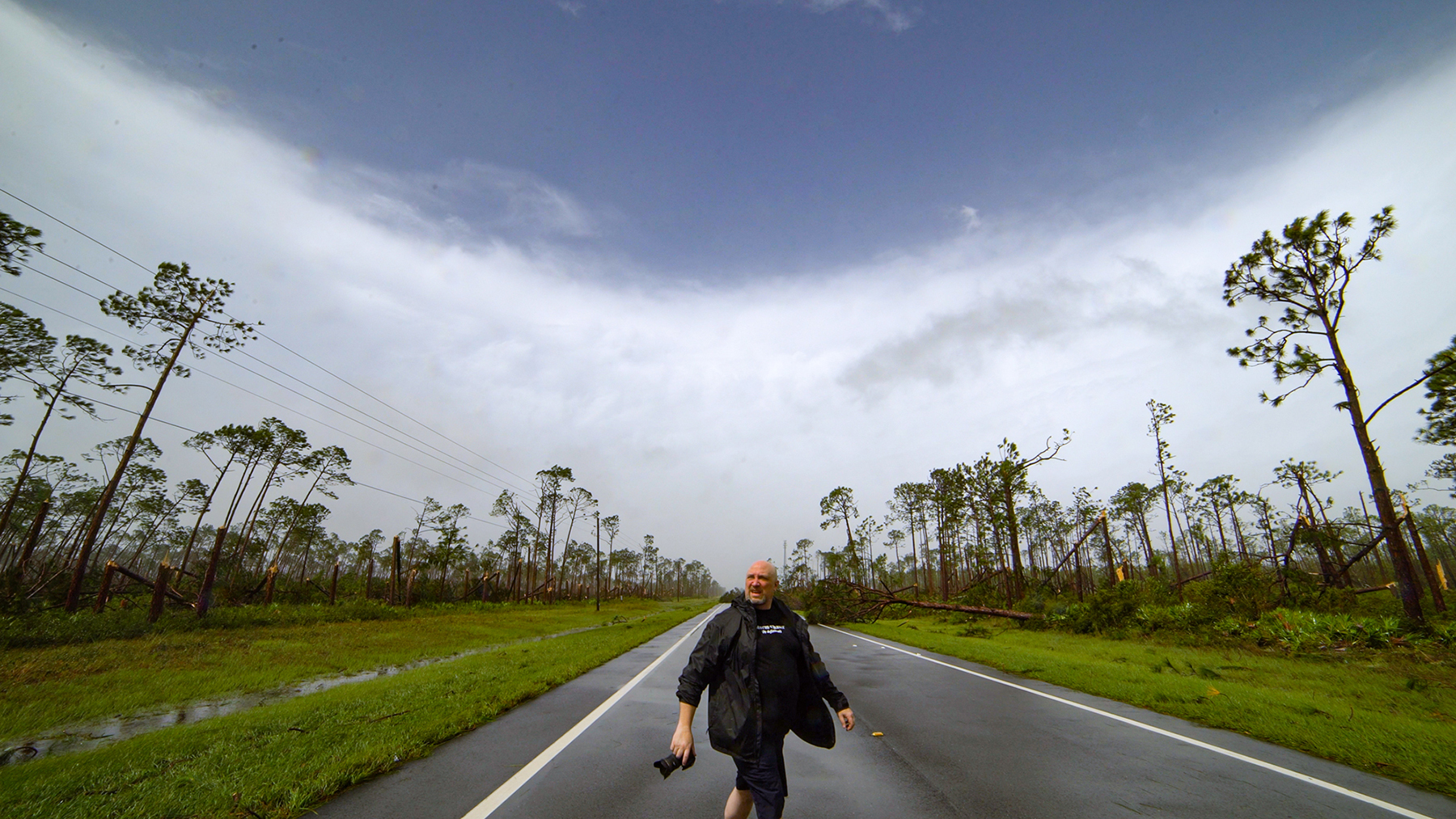
In the city of Paynesville, I found that power was out to part of the city as numerous tree’s and tree limbs were blown down by straight line winds that helped to knock down the power lines. Someone told me that the transformer at the hospital blew up due to the storm. The firefighters told me that in the Cenex parking lot on old highway 23, large semi tractor trailer was blown over on its side and lots of trees were on buildings on the north side of town. They were correct. I saw a lot of damage and it looked like the possibility a micro burst combined with a lot of lightning that hit the area as everything was blown in the same direction over a several block area. I did not see much damage near my brothers cabin and off to the east of town so the damage was localized to the city of Paynesville.
This weekend has been a roller coaster for forecasting and chasing. With the crazy weather setups and forecasts for the Midwest looked great the day before, on the day of the chase, everything was not as great and chase targets have been way off target for a lot of people.
On June 4th, the main area of risk and where most of the chasers went to go cover was in central Kansas. A few stayed in Wyoming while the Colorado chasers I work with knew that the Palmer Devide area is always magical for weather. That was the day Eric Treece and Verne Carlson got amazing if not insane footage. Tony was pretty pissed that he went to Kansas along with others but all it takes is a degree or two in the cap and you get major storms or major busts. The setup was a little different in Colorado then it was in Kansas and with the dynamics of the area, Colorado won the day for severe weather.
The next day, virtually everyone that was in Kansas and could chase went back to Colorado to chase. A few unlucky chasers I know had to go back to work and go home. No disrespect to them since obligations are just that, OBLIGATIONS. I know I get shit from a few arm chair SPC chasers that say I don’t chase anymore when I have 50 people out in the field and I have obligations to them to make sure I’m working the news desk and to take care of them. At the same time, were in the June weather setup now, the weather pattern is shifting north, and we have the ridge setting up where it will bring the storms up north. Why drive all over the place when I don’t have to and can just wait for the weather to come to me?
Saturday was just one of those days where I wait for it to come to me. I woke up early to what I thought would be a pack up and take a trip to Nebraska to chase and then looking at the forecasts I said, eh, I think I will stay home. The area by McCook Nebraska would fire first and the area to the northeast would get screwed over. Where there storms in the area of northeastern Nebraska? Yes! Where there storms that were worth my time to drive 10 hours round trip along with an additional 4 hours of waiting and chasing to blow off a possible local chase where I saw a major flooding issue? That’s where I said, eh, no, I will stay home.
The decision to stay home was a good call as the flooding event did take place.
6/7/2015 Centeral MN Overnight flooding
The area just to the north and west of Saint Cloud was hit with at least five inches of rain. At one point Neva and I were documenting the flash flooding in Sartell, MN where several feet of water was in front of the police and fire department.
As we checked into the areas further to the northwest, the flooding and washed out roads were also pretty bad. You would have never known since MPX seems to have ignored the reports of the flooding in the area yet again. After seeing the flash flooding and the reports once again being blown off by the weather service, I’m just not going to bother to report anything anymore.
This week looks to be a busy week for severe weather again and I’ll be out chasing with the setups being closer to home and up north.
P.S. Last nights storms, missed those due to staying home to repair the dishwasher and I was not able to get out in time. Neva took off in her truck and shot some cool lightning photos while I was trying to play catch up with the storm.
The website infrastructure has been overhauled and now the core of everything here is up and running smoothly for my personal blog. The only problem I have now is that “Too Much Happens In A Day”
With all the side projects that I have agreed to help out with oer the last year or so from wedding videos, charity videos and just helping friends out, I have not had time for myself and barely had enough time for my business so the blog or I will like to call it going forward, “My Journal” had suffered immensely.
Today, or was it yesterday, I can not recall since I have yet to sleep, but sine I’m still awake, I will say it is today even though it happened technically yesterday since it is five in the morning, was pretty insane. A good friend of mine and one of the StormChasingVideo.com crew got some amazing footage but I also had flashbacks to 5/31/2013 or “El Reno” when I lost a couple of friends. Verne got caught up in the storm and drove down the wrong road and got hit by the tornado.
Many times while storm chasing, we depend on technology to help us with mapping and location in relation to the storm. What happens when the road that is on the map is no longer there? Today Verne had that problem. The road that was suppose to be an escape route turned into what he said was a “Two Mile Driveway” that when he got to the house at the end, there was no where left to go?
Here is the footage he shot. It is pretty insane.
6/4/2015 Storm Chaser Hit By Simla, CO Tornado
Now this was not the only video we had from today. If you go to www.stormchasingvideo.com you will see we had some great footage from Ben McMillan who was live streaming most of the day. Justin King had some great storm damage footage from just south of Loveland. Eric Treece and Brian Barnes were on the same storm as Verne. So Yes, Too Much Happens In A Day, but I fit it all in somehow.
Now the question is how to fall asleep and get up early enough to be ready for today’s or do I call it “Tomorrows Storms?” Not sure how but maybe a couple of shots of Tequila could help but I doubt it. Time to lay my head down next to Charley (aka Happy Cat) and let the purring from him help me start to mellow out and get a few hours of sleep before hitting the news desk again.
Going Retro… After years of ignoring my website and depending on “Social Media” for my posts which in the end are not my own if you read the Terms Of Service, I’m going back to updating my website on a much more regular basis.
Just like the photo below, I’m going retro, going back to listening to albums because they sound better and their more personal.
found my old albums from years ago
Now that it took a month to clean up and transfer the database, the updates should be flowing a lot more after I take care of the final bit of work this week, and I hope it might even be today or tomorrow.