Back home from the chase to Iowa.

Today was a different chase, was not that impressed with the setup but I was able to chase to I made the most of it.

Target this morning was the area around Blue Earth, MN to Mankato, MN. I left the house after lunch as the first cell of the day fired up and dropped large hail west of the Twin Cities metro and I was able to avoid that storm. I saw reports of hail up to four inches in size. No thank you, that would destroy my Jeep and I was focused on finding some rotation and maybe a lightning strike or two.

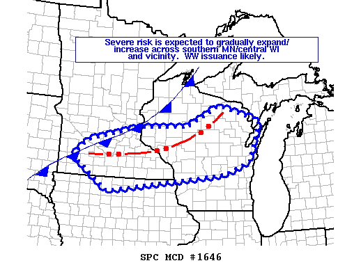
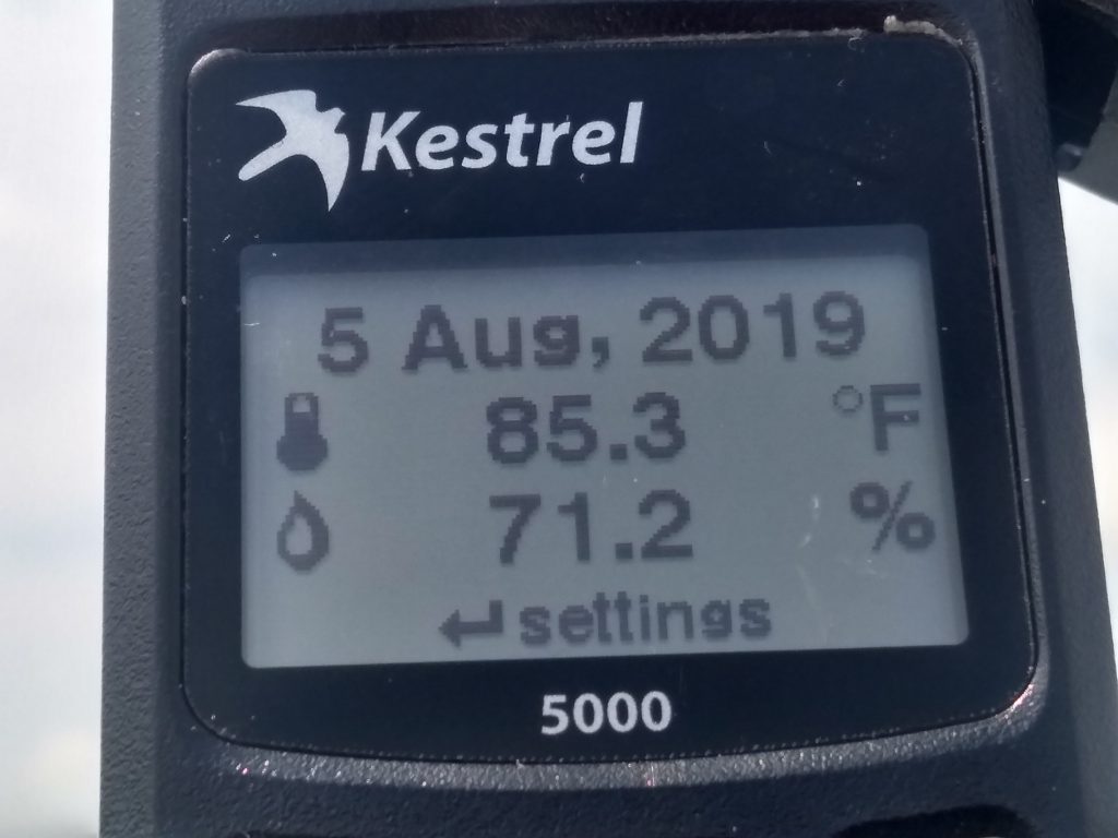
Just north of Medford, MN, I stopped to check the data since Minnesota is now Hands Free and I can’t use half of my equipment while chasing. Saw the data and the MD for a possible watch that I posted earlier today. I checked the weather data and yes, it was MOIST!

Kestrel 5000 showing it was MOIST!

The problem with today was the upper level winds. The storms had some sheer and were rotating but they were not moving all that fast and pretty much sat in place as they grew and started raining and eventually rained themselves out and created outflow and new storms.

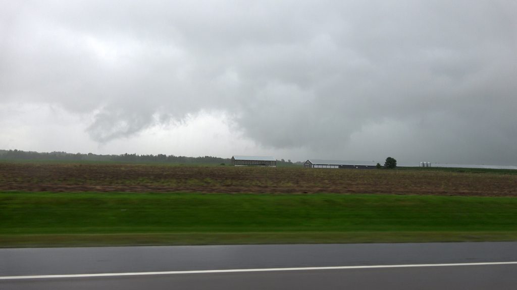
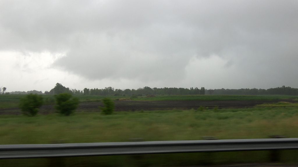
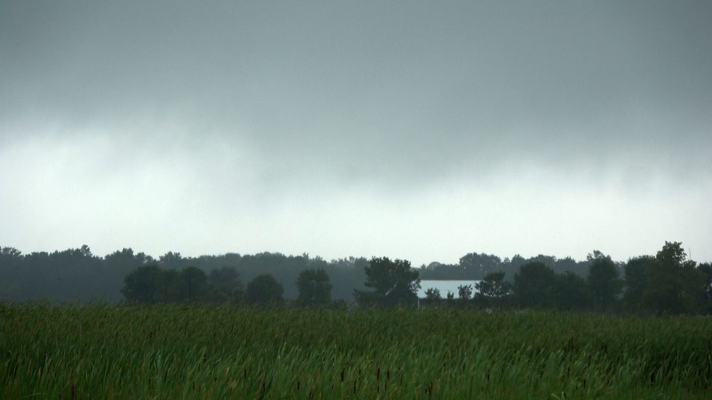
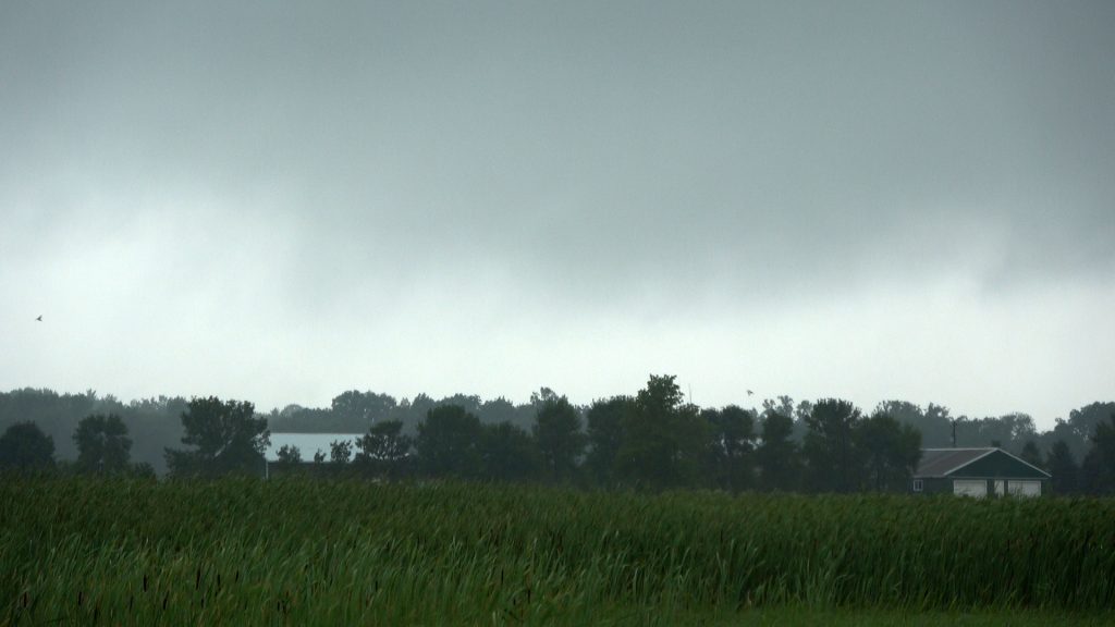
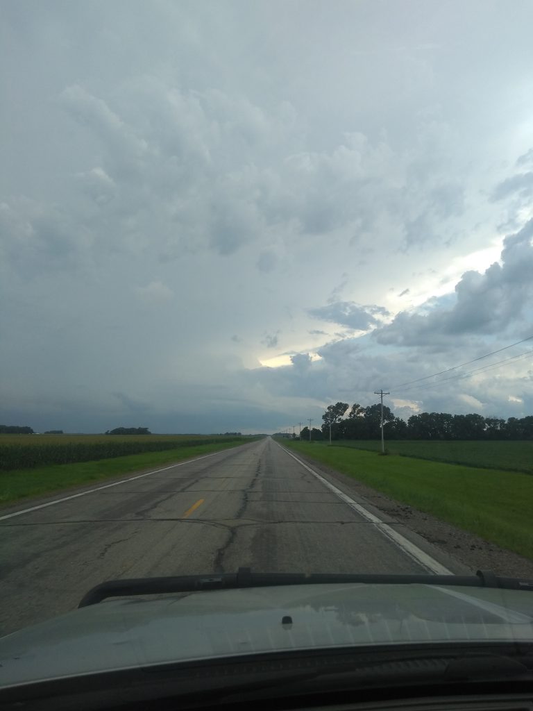
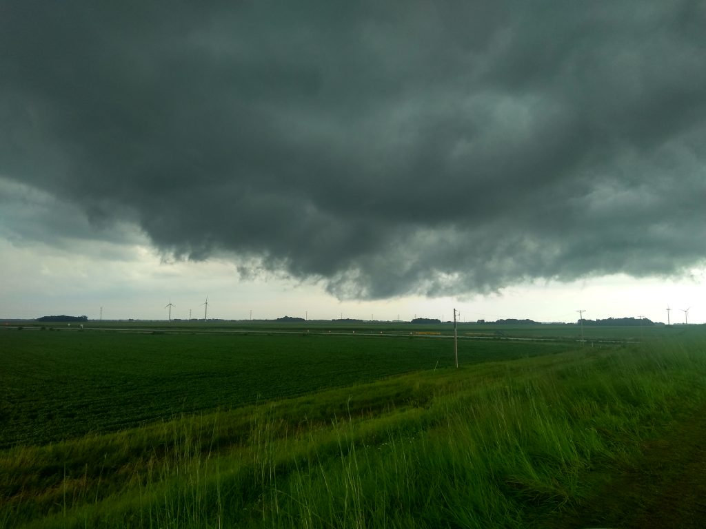
The first storm of the day near Owatonna, MN was trying but it was just not that impressive while the original target area did have a storm that was over 51,000 feet tall. So I headed southwest and intercepted the storm near Amboy, MN . Below is a photo of the storm as it was growing before it became outflow dominate.

Severe Storm brewing near Amboy, MN

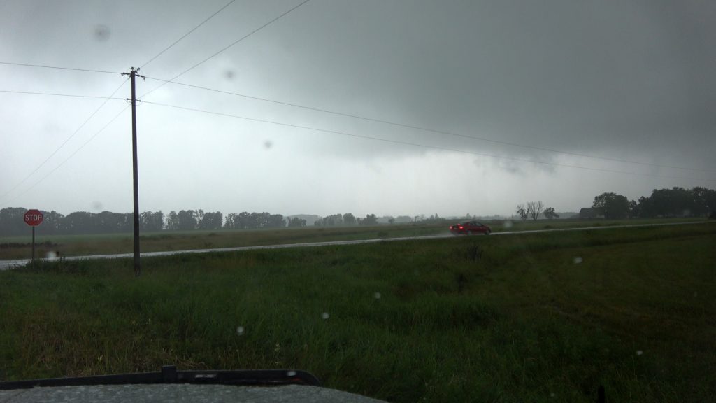
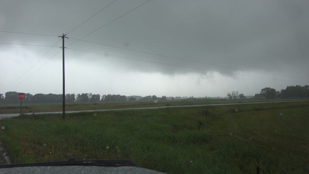
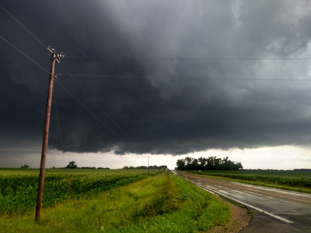
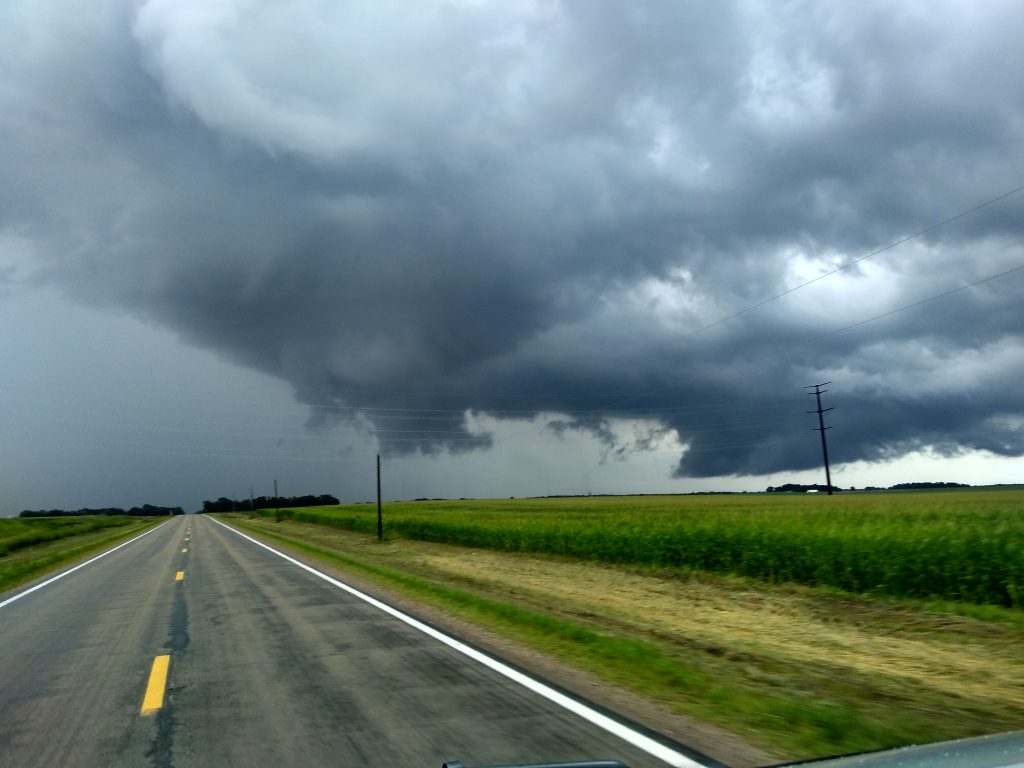
When I got over to the base of this storm, it split but I followed this to Blue Earth, MN and into Iowa.

North of Blue Earth, MN

Blue Earth, MN Wall Cloud forming and weak rotation.
Lowering and rotation near Blue Earth, MN

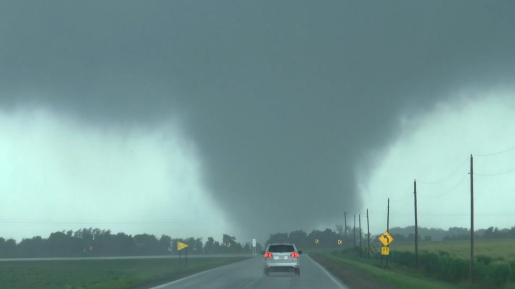
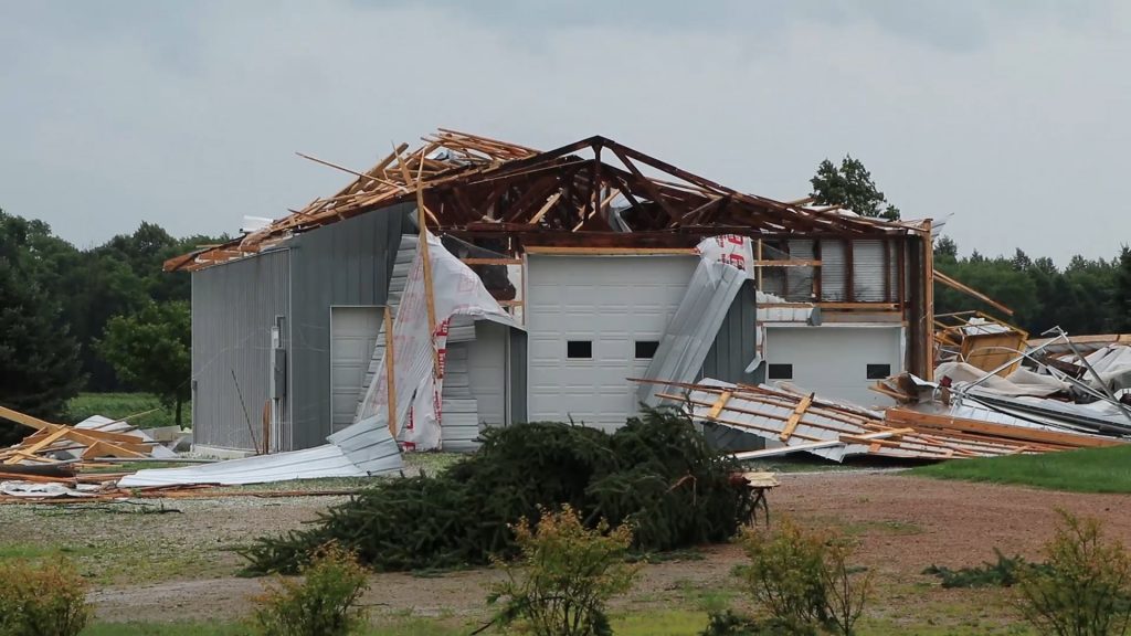
*** Update *** I was going to just edit the video later today (Tuesday) but I started reviewing the footage and I actually got a brief touch down when I continued to follow the storms into Winnebago County, Iowa and I was pretty much shocked that it showed up on the camera but I could not see it but then again I had so much going on at that time with three different cameras and watching out for the storm that was about to slam the area I was at.

Here is the video from Winnebago County, IA

Winnebago County, IA Tornado, Funnel, Lightning Time-Lapse – 8/5/2019

8/5/2019 Chase Update

In the field now, decided to chase today. Targeting south central Minnesota and an MD just came out. Heading down to Owatonna now.

 Mesoscale Discussion 1646
   NWS Storm Prediction Center Norman OK
   0118 PM CDT Mon Aug 05 2019

   Areas affected...parts of central and northern Wisconsin...southern
   Minnesota...and adjacent northern Iowa

   Concerning...Severe potential...Watch likely 

   Valid 051818Z - 052015Z

   Probability of Watch Issuance...80 percent

   SUMMARY...Severe potential is forecast to gradually increase across
   the discussion area, on the southern fringe of ongoing convection. 
   Watch issuance is likely.

   DISCUSSION...Latest radar loop shows a band of thunderstorms moving
   east across western Upper Michigan and northern Wisconsin, while
   additional storms are increasing in coverage along the southern
   fringe of the ongoing band -- and westward along remnant outflow
   over southern Minnesota.

   The airmass ahead of the storms/convective outflow continues to
   heat/destabilize, with objective analysis showing 2000 to 3000 J/kg
   mixed-layer CAPE -- in line with the 17Z special RAOB from MPX.  

   Latest VWPs, and the MPX RAOB, show low-level southerly/
   southwesterly flow veering to northwesterly aloft, and increasing
   40-plus knots at mid levels.  Resulting shear is supportive of
   organized/long-lived storms, and is contributing to an
   intense/long-lived updraft which moved through the Minneapolis metro
   area and has produced hail to tennis-ball size.

   As storms continue to increase -- and likely organize eventually
   into a south/southeastward-moving MCS, risk for severe weather will
   likewise ramp up.  As such, WW issuance will become increasingly
   likely over the next hour or so.

   ..Goss/Dial.. 08/05/2019

“Behind The Chase” Reboot July 2019 – Crazy Hail Storm Chase

Behind the chase reboot

Welcome to the first look at the reboot of the Behind The Chase, the StormChasingVideo.com blog video or “VLOG” that I never had a chance to do and was not sure what direction to take it. Now that the personal site is updated and up and running, time to give it another chance with weekly and several times a week in depth behind the chase info.

In this Behind The Chase, I bring you along on a chase where you don’t have to sit and watch it live and wait for something to happen. Now were editing the video after the chase to virtually ride along with us.

In this episode, ride along with for a behind the scenes look at the Sherburne County, MN, Intense Hail Storm – 7/26/2019. Yes, I’m a huge Rush fan and see if you can catch my Rush reference in the video about the hail storm.

The Behind The Chase video’s are going to be unlisted and published here first on my personal website for at least a half day before being made public on Youtube.

I have to get the pages up and running for the give away to have all the legal stuff to comply with Youtube terms of service for give away and contest rules. I will be working on that tomorrow for the next video. Until then, enjoy a sneak peak at the reboot of Behind The Chase.

It was a good day yesterday.

Hey Weather Paparazzi fan’s, just an update from the weekend as it was decent. On Friday I told Nick and Mandy that I was taking Sunday off and they said no, it’s a chase day but I said it was a chill day for my Birthday and wanted to just sleep in and relax. Well I did get just that. Neva kept Laura from waking me up and I actually slept until a little past noon, and it was amazing! For those of you that don’t have kids, you won’t understand and for those of you that do, you get it.

I know some thought I was being a downer on the storms yesterday since it did look good but I just wanted a chill day. Well the MD came out, then the tornado watch and finally a tornado warning, all while watching the radar and I told Neva I had to go chase as the storm over Saint Cloud was about about to produce.

As soon as I drove over to the east side of town…
BULLETIN – EAS ACTIVATION REQUESTED
Tornado Warning
National Weather Service Twin Cities/Chanhassen MN
337 PM CDT Sun Jul 28 2019

The National Weather Service in The Twin Cities has issued a

* Tornado Warning for…
Southeastern Benton County in central Minnesota…
Northwestern Sherburne County in central Minnesota…

* Until 415 PM CDT.

* At 336 PM CDT, a severe thunderstorm capable of producing a tornado
was located near Clear Lake, or 10 miles east of St. Cloud, moving
northeast at 30 mph.

HAZARD…Tornado.

SOURCE…Radar indicated rotation.

Here are some images of the chase. And no these are not watermarked as they are on MY website under my terms of service and no they may not be reproduced on your site.

And then there was the chase from Nick and Mandy down south who called this one on Friday, yes, 48 hours before the chase. Again, SCV images, they are contracted with SCV, I own SCV and the images are hosted on company property and this website so no fair use allowed 🙂

And here is their video from yesterday.

Biscay, MN Violent Tornado And Destroyed Buildings – 7/28/2019

Week in the news – 7/27/2019

This week has been pretty crazy with the news while trying to work on finishing the website move and update.

Did make top local story for KNSI, KSTP and even Star Tribune with the Paynesville, MN Tragedy.

Screen Capture of the story on KSTP.

Then last nights hail storm was one of the main weather stories for Good Morning American on ABC News.

Hail storm screen capture on ABC GMA.

Tomorrow I plan on finishing the blog video, something new that I plan on doing finally that has been in the works for years.

Oh Hail Yes

If you are seeing this and the domain name says WeatherPaparazzi.com, you are on the new website home for my website.

First off, MONTHS of repairs, re coding, cleaning, spell checking, grammar checking and editing is completed as of 7/26/2019.

For those wondering if and asking “Do You Still Chase” Yes I do and now that I have this 20 year old mess of website cleaned up and working for the first time in years, I’m going to be a lot more vocal about stuff since I’m no longer going to be depending on Facebook or other social media sites to host my work but only be used as a search engine for my work. EVERYTHING is on my page and images will be clean and uncompressed and points of view will be uncensored!

Oh yeah, “Do I Still Chase? Yes and now that the backlog of office crap is getting caught up, going to be out a lot more later this season and next season.

Here is my news video from just south east of home. I’m working on a blog video to post later tonight.

Sherburne County, MN, Intense Hail Storm – 7/26/2019

It ends here tonight!

If you are seeing this on 7/25/2016 at 11:51 PM, this site is gone.  

*** Update *** Well actually, if you are seeing this, you are on the new site framework.

I have spent the last 6 months rebuilding and moving EVERYTHING over to a new system and reviewed the last 18 years of my life… Crazy eh? 

Don’t worry, everything is not lost, but something new, something beautiful, SOMETHING WITH SPELL CHECK AND grammar checking that was about 25 years overdue is in the works.  All the data, files and actual working links are all here on this page you are reading. I did this to preserve all of my old work so that one day when I’m long gone, I will leave something behind for my daughter to review and read that is NOT on FaceBook or some other social media site. I also did this because I wanted to take back MY social media posts and MY content to MY site where I am the only censor and the images and or video posted is NOT in some highly compressed format but the clean pristine clear image quality that we had before Anti Social Media and any advertising that happened to be on this page, yeah, I get paid for it, NOT some social media company.

Now that the site content is all over here, I will be working on moving about 5 years of my social media life from CRACKBOOK, (Facebook) back over here to this site. I’m also going to be blogging and VLOGGING (Video Blogging) a lot more.

Some people thought and have said “Do You Even Chase Anymore” and the answer was and always is, YES but my website sucked so I never posted. Well, I’M BACK!

I’m working on the transition of all the old content from the sand box site, the Dot Net site and working on moving it back to the the main site, the dot.com site.

Right now, if you see this site and it is the WeatherPaparazzi.com site, and this is NOT the top or current blog, you are on the new setup. Otherwise, if this is the top post, you are on the www.weatherpaparazzi.com site

Thank you,

Doug

Some days, you just see the results of Pure Evil.

Just got back home and edited the video for the local news and the Youtube Channel since I have a large local following here in Minnesota since I cover more out state then metro news.

I had a feeling that today was going to be one of those days that is just F’d Up. I wanted to work on the website and literally at the point of writing this blog, I have 14 pages to move over and then finalize the entire move for WeatherPaparazzi.com and reclaim my life, content and blog. Unfortunately it seems as though whenever I get so close to finalizing a project, I encounter the greatest resistance to accomplishing the task at hand.

Today, errrr, Yestertday was one of those times where I was all set, making some coffee in the office and had dinner started while Neva and Laura were at the park. I was listening to the scanner when a call came over the radio like something out of a F’n horror movie that was happening in Paynesville, MN. A man was pouring gasoline on the children and pets while the woman was screaming calling 911. The next thing I heard on the radio was that the trailer park was on fire. Then I hear the police were on the scene and can hear people screaming inside but they can’t get inside to help them.

Last report I heard was two children were life flighted to the hospital, not sure but I assume it was probably HCMC or North Memorial burn unit.

Below is the video I posted to Youtube. I could not put too much detail on the Youtube video since the description about what was happening would probably get the channel or video flagged but I did edit in all the audio from the scanner traffic to tell the story about what was happening.

News B-Roll footage from the Paynesville, MN Arrson

Final push this weekend…

I know I have said that before but now that all of the hurricane blog pages are moved to the new temp setup www.weatherpaparazzi.com, I have 6 menu pages left to clean up and move.

That is about 60+ total more blogs to rebuild and then work on the transfer and recreation and rebirth. 

I can tell you that the hurricane blogs were a total disaster, I mean they were screwed and it took me four hours just to fix all the video and photography in the Hurricane Katrina blog.

I do have to recreate the Katrina Nine Months Later blog page along with the move of all the last of the stuff that is on this site. Then transfer the database then rebuild the .net to the .com and then move the older Facebook blogs to here. 

I’m taking my content back for good!!!

The Mess Of My Social Media Life

Now that I spent MONTHS cleaning up the mess of my social media life…  God, that sounds like an amazing book title, “The Mess Of My Social Media Life”  How social media almost destroyed my photography and video websites…  

Right now the bulk of the posts are on WeatherPaparazzi.net  Once everything from the old dot com site is moved over and recreated, it will be moved back to this domain name.  

I’m finding so many images that have never seen the light of day while auditing and moving everything. Get ready for a massive update of new photography in August 2019.