
I just got back in from shooting a ton of footage around New Orleans of the last minute prep work that is being done. There are more police on the street then I have ever seen. This place is a police convention!!!
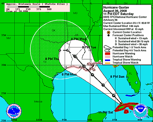
I’m looking at the latest data and I’m a bit concerned after looking at the latest GFDL and HWRF forecast model runs. They show that Gustav is going to be a strong storm and then die right as it moves over land. Here is the 11pm NHC forecast track showing the storm is a Strong Cat 4 with winds of 140 MPH.
Now here is the 2AM NHC forecast map that shows the storm has lost some strength since the last update.
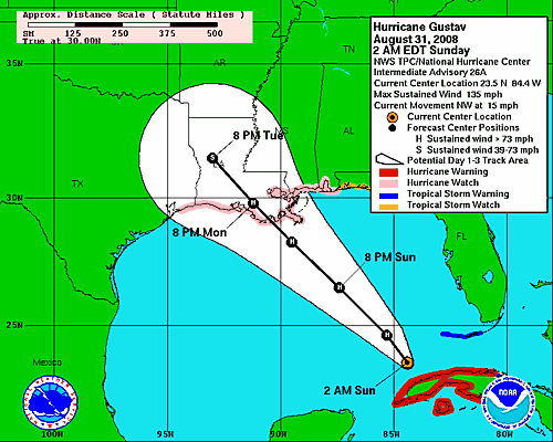
Notice that the track keeps moving more and more to the east now compared to yesterday. I have a feeling that the cone may shift more towards the LA and MS boarder area. I think were going to be in for a surprise with this forecast by this time tomorrow.
Off to get some sleep now for a few hours.