
I spent the day shooting ton’s of footage on the new camera I have been testing out. It’s the HD Sony EX1 XDCam tapeless setup and the Underwater setup on the other camera.
For most of the day I scouted out the area around New Orleans and it is going to be insane when this storm hits. This place is in a state of panic but it is in a controlled panic. Controlled as in everyone is getting out of here and the evacuation is already started with tons of people leaving. My evacuation forecast for NOLA is their will be more law enforcement then people in the region when the storm hits.
And now on to the storm.
Here is the latest NHC forecast track for Hurricane Gustav and the track is shifting east more and more.
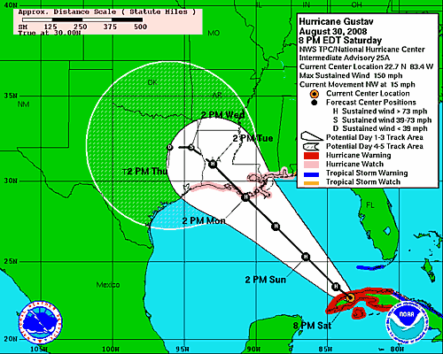
Yes, that is correct, the winds are 150 miles per hour and it is heading almost straight for me. The good news, I’m here and their won’t be very many other chasers here due to the fact that the Police and National Guard are booting everyone out. The bad news is that we may be stuck here for a while.
Here is the latest visible satellite images before sunset. Gustav has a very well defined eye on it and it made a direct hit on the Isle of Youth in Cuba and is now slamming into western Cuba during the overnight hours as it enters the Gulf of Mexico.
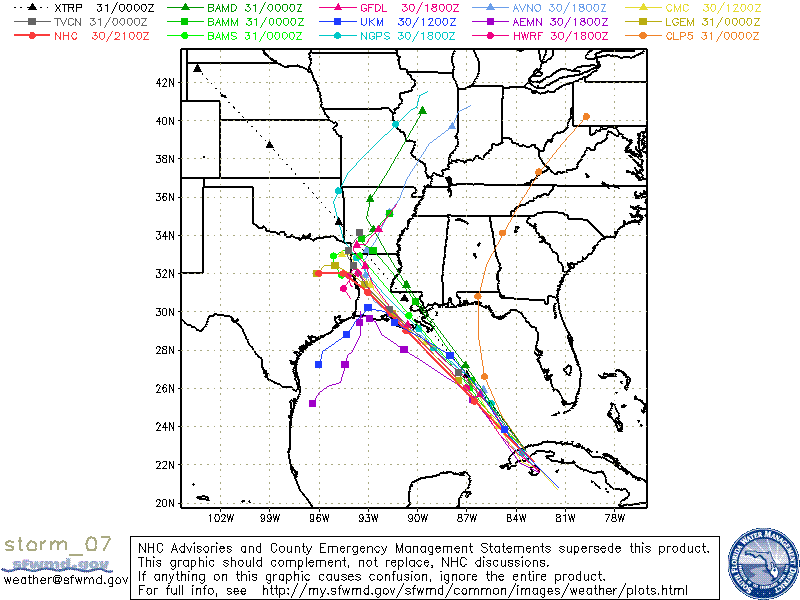
In all honesty, nobody knows were this storm will hit. Just look at all the computer models below. This thing could end up hitting Florida still.
Ok, time to get some rest before I go back out and do it all over again.