
Yes, I said it, is Ike Heading for Mexico? Looking at the latest GFDL computer model, the hurricane Ike intercept may be put on hold or might be dead for now.
Below is the 96 hour GFDL forecast model showing Ike is going to strike just at the boarder of Mexico and Texas and if the current westward trends continue Ike may end up heading south of the boarder.
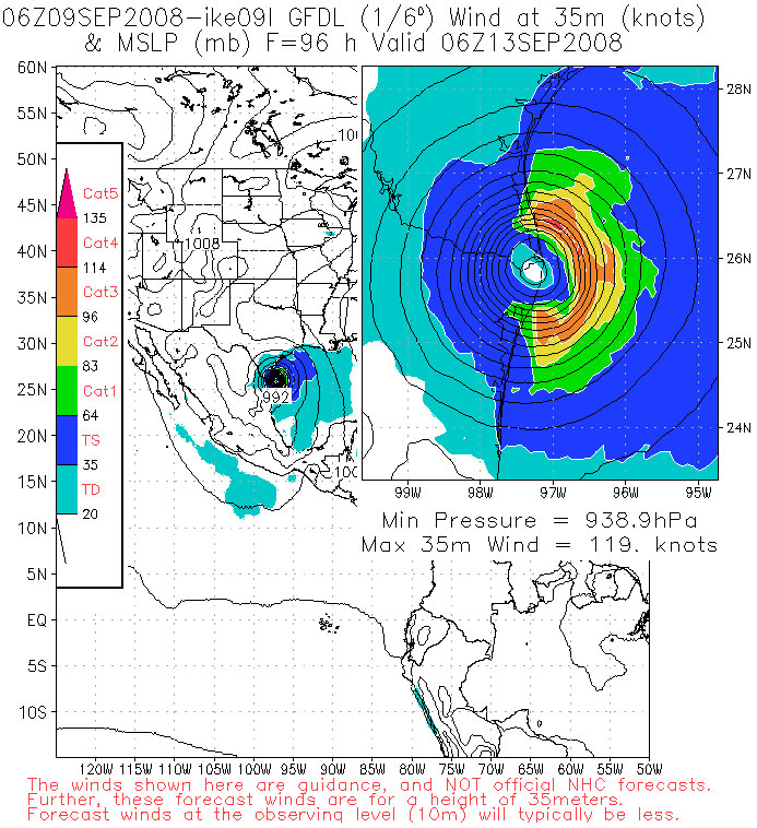
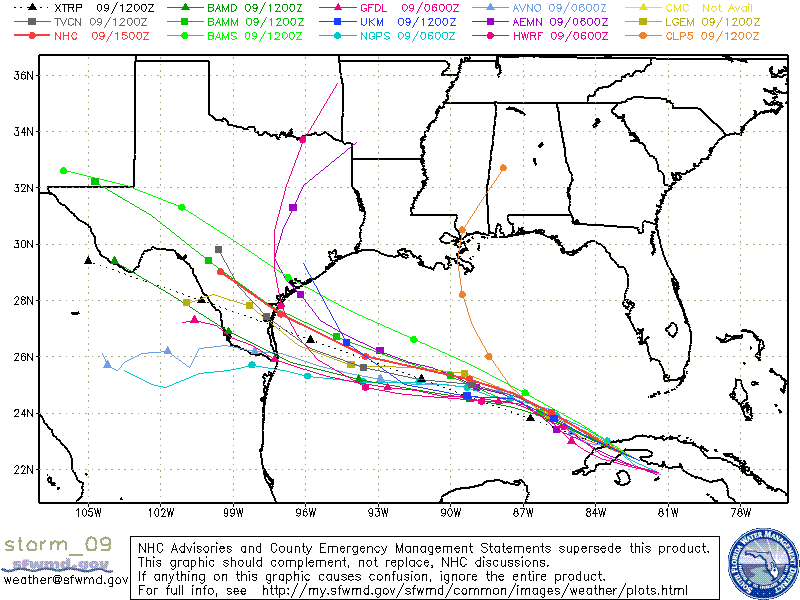
Now granted this is just a computer model and there are several computer models for forecasting hurricanes. The problem is now they are all starting to show the same movement for Ike towards the USA and Mexico boarder.
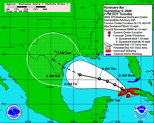
The latest 2PM forecast from the NHC now shows an even more west jump to Ike.
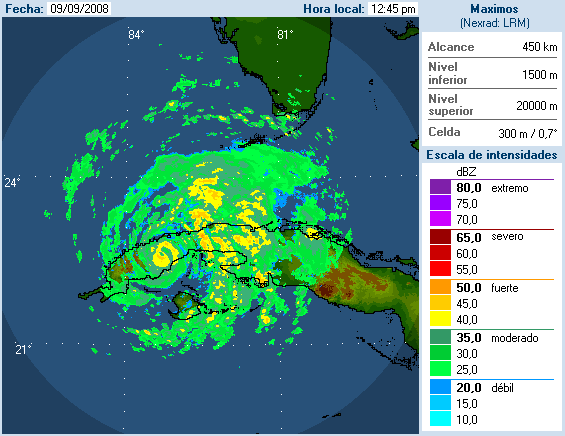
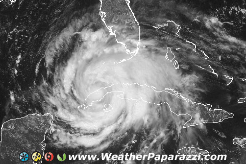
And the Radar from Cuba shows that Ike took a beating from it’s run along the length of Cuba but it did not drop below Cat 1 Hurricane status. This means that if Ike can make it off the island of Cuba back into the Gulf, it may end up being yet another surprise for everyone.
So, what is in store for Hurricane Ike? I don’t know to be honest. I want to chase one more hurricane this season but it costs several thousand to get everything geared up and in place to chase the hurricanes and with the chance of the storm moving off into Mexico, I just don’t know if it will be worth it. I talked to Chris today who pretty much said he is going to blow this storm off too. The main reason is the size of the storm. The center where the worst of the worst will be is tiny and all you need is a 15 -20 mile shift in the track forecast to make it into a extreme chase or into a waste of time. Unless something happens in the next 24 hour’s, this is not looking like something that will be worth chasing. Back to waiting and watching.